Table of Contents
1 – Intro
2 – Stein Resources
3 – Author Background/Experience
4 – Access
5 – How to Experience the Stein
6 – Commentary on Lower Valley Camping
7 – Commentary on the Stein Traverse
8 – Commentary on the Mini Traverse
9 – Trail Descriptions
10 – Packrafting / Kayaking
11 – Other Creative Trip Options
1 – Intro
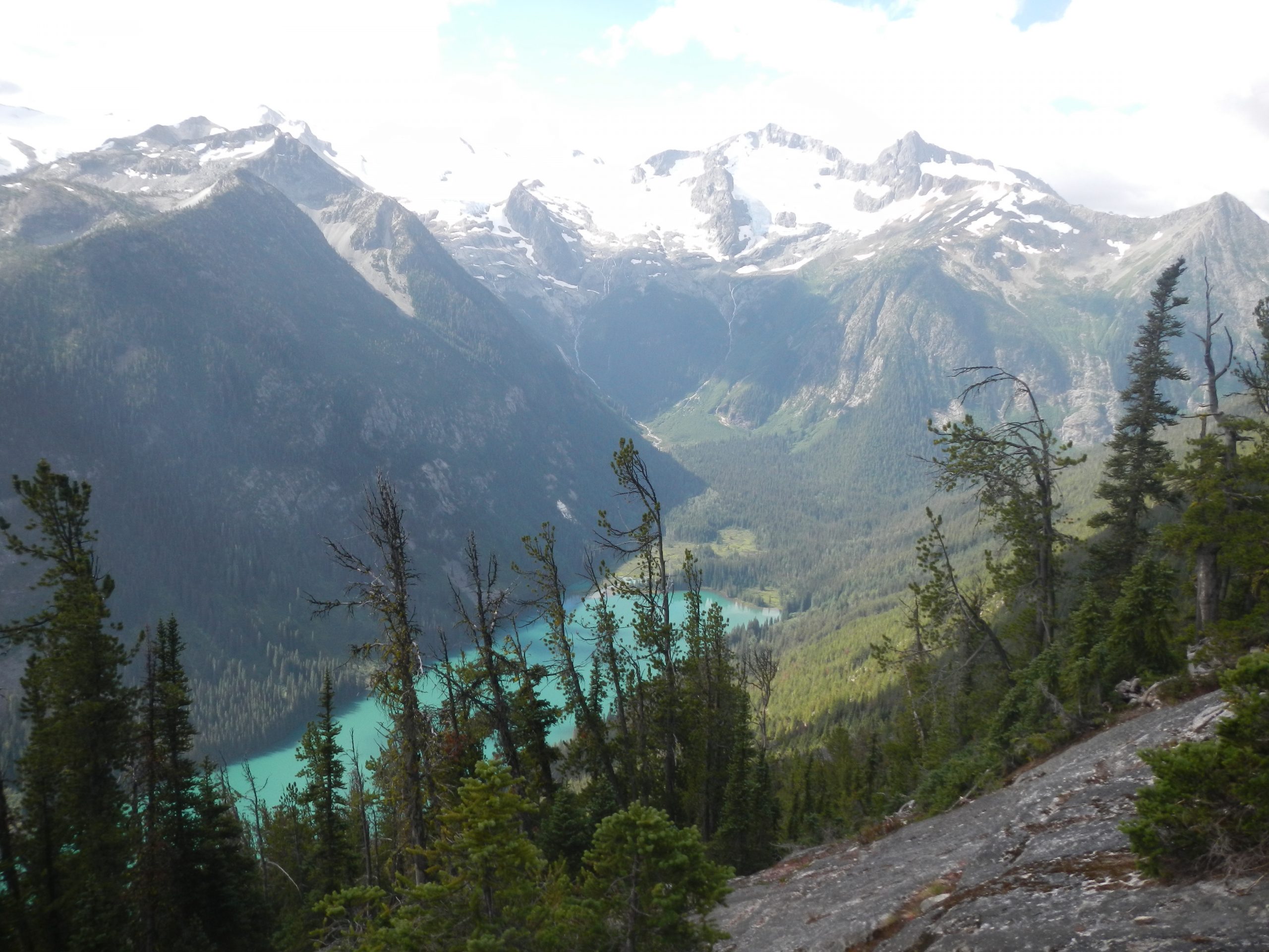
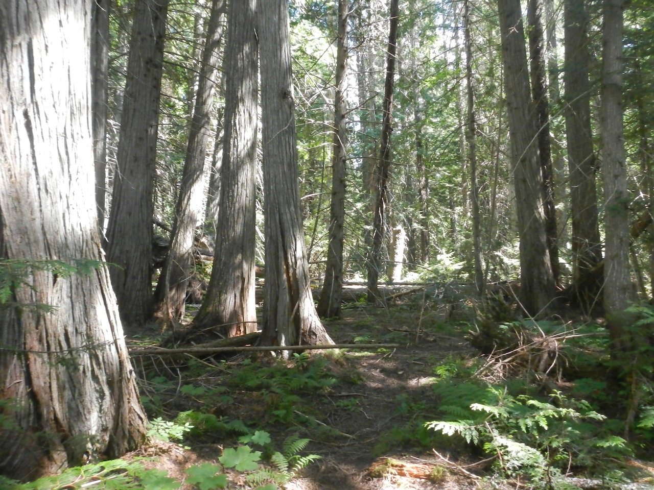
The Stein Valley is a wilderness area in Southwestern BC, Canada. The entire watershed (1070 square kilometers) has been protected in a provincial park after a prolonged conservation battle in the 70-90’s. Thanks to the passion of that generation, none of the Stein drainage has ever been logged and industrial activity has been non-existent other than a small and defunct silver mine.
The Stein Valley is unique in that it is the only park in North America in close proximity to an urban center (>1 million people) with an intact suite of top predators. Grizzly, wolf, cougar, wolverine and lynx are all here.
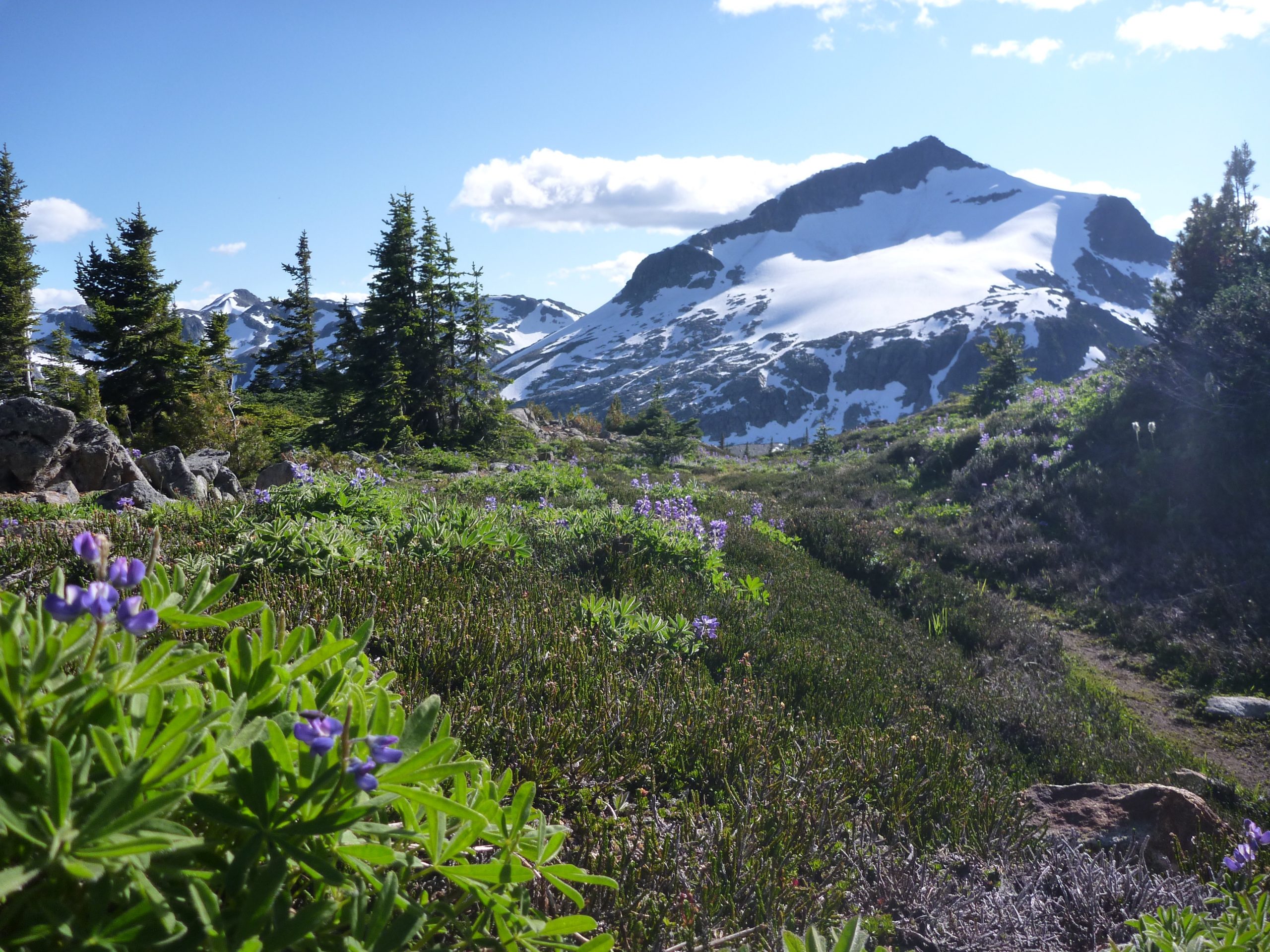
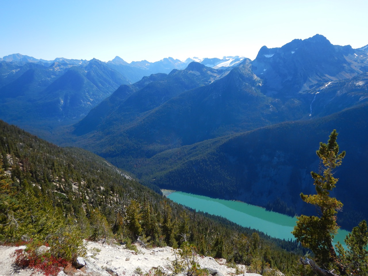
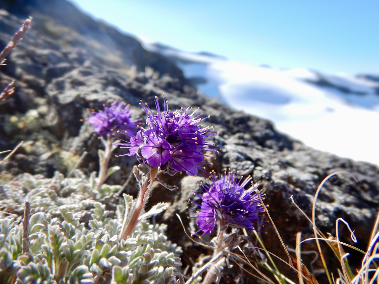
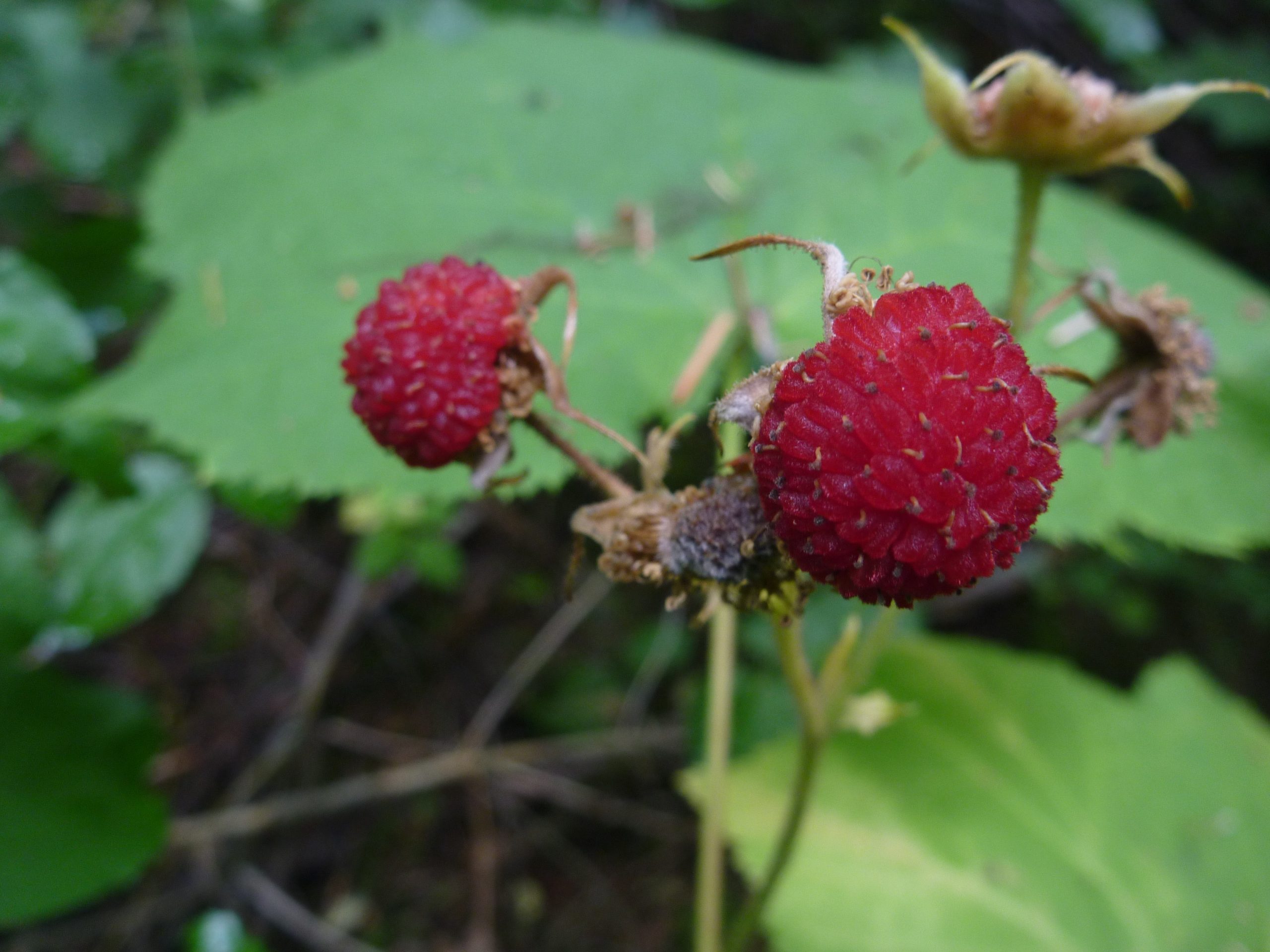
Despite the close urban proximity, visitorship is sparse and recreation opportunities are wonderfully underdeveloped. Attractions include alpine lakes where glaciers calve mini icebergs, hundreds of kilometers walkable of alpine ridges, the tallest peaks in southwestern BC, the Klackarpun icefield, 60km of wild river and about 150km of developed trails/routes.
Due to lack of amenities, development and publicity, recreation in the Stein Valley low. The main access point at the river mouth is visited regularly by weekend hikers – usually as a 1 or 2 night out and back trip, but I estimate less than 100 people per year make it into the heart of the park (but I keep having to update this estimate – when I first wrote the guide it was 25).

In this short guide, I’ll opine on how best to experience the park, comment on popular trips, provide basic trail beta and suggest a number of untested but possibly outstanding (or terrible) routes.
While this guide provides general beta on the main trails, it lags substantially behind G. White’s guidebook in terms of detailed trail info, local ecology and history. I highly recommend picking up G. White’s guide. The unique attributes of this guide are the more up to date trail conditions, off-trail route suggestions and unbeatably low price.
2 – Resources:
Maps:
Stein to Joffre by Trail Ventures – Best map but cuts off parts of the southern divide.
ITMB Stein map – Older, ugly and not particularly accurate
Lizzie Creek Backcountry Ski Map – Ski possibilities in the Lizzie area.
CalTopo Online Map – I created this quick online map for the Stein but the tracks in orange are merely rough sketches, not to be relied upon. Please record and submit better GPS tracks.
Books:
Stein Valley Wilderness Guide 2ED, Gordon White 2013 – Good guidebook. Re-uses a lot of beta from Freeman and Thompson but substantially expanded and updated.
Stein: The Way of the River, M’Gonigle & Wickwire 1988 – Fantastic historical info. Not a guide.
Exploring the Stein River Valley, Freeman and Thompson 1979 – Outdated but neat piece of history.
GPS Tracks:
Here is a GPS track for the Stein Traverse (right click -> Download linked file). You may have to delete the “.xml” extension. Or you can see that on an online map here. It looks pretty good but I haven’t used it personally so use it at your own risk.
3 – Author Background / Stein Experience:
I’ve hiked the full Stein Traverse four times (2010, 2011, 2012, 2017) which took 8 days (2010, 2011), 2 days (2012) or 1 day (2017). I’ve also camped in the lower valley, rafted the middle Stein, hiked to Kent Lake and skied/hiked the “mini traverse” (Blowdown Pass to Lytton) solo in winter 2015 and scrambled peaks in the Blowdown and Lizzie areas. I’ve also skied in the Lizzie Creek area on several occasions and tried to ski the southern divide twice but never made much past Caltha due to the weather. In the summer I’ve been as far as Mt. Cline on the southern divide.
4 – Access:
The most popular access to the Stein is from the east (Lytton) but there is also access from the west and north sides. Coming in from the south would require combining logging roads with an off-trail route of your own creation.
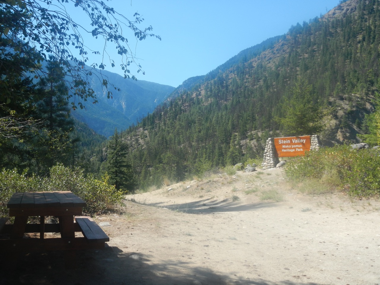
The main access from the east is the only access with normal park amenities (signage, washrooms, picnic tables). To get here, drive to just north of Lytton, BC on Hwy 12 where you turn west onto Lytton Ferry Rd, which unsurprisingly ends at a ferry over the Fraser River. Cross the river on the free ferry, which doesn’t run at night or during a few breaks. Across the ferry, turn right (north) and drive for about 5km, at which point a few not that obvious signs will direct you down a dirt road (1km) into the park. If you cross the Stein River, you’ve missed the turn. In the spring the ferry can close during high waters, but you can cross the Fraser via a footbridge near the mouth of the Stein (technically closed but a short walk) or via a footbridge that is part of the rail bridge at the town of Lytton (longer walk).
The other access points are from the north and west. From the north, you can drive up the Blowdown Creek FSR from Duffey Lake road for about 10km. I’ve done it in a 2WD car, but the numerous water bars are a challenge so you want to be driving a car you don’t mind scraping up a bit. A jeep could make it a few kms further to the pass via the old silver mining road, but most folks hike up. The old road continues several kilometers into the Stein, but please respect the non-motorized laws, as driving further where other folks are hiking is lame and detracts from their recreation.
For western access, head east on hwy 99 from Pemberton, BC after stopping for coffee at the Mt. Currie Coffee Co. or the Blackbird Bakery. After 8km, turn right to stay on the 99 (well signed) in the town of Mt. Currie and then 17km after leaving Pemberton you’ll be driving past Lillooet Lake. Just past the lake, turn right onto the In-SHUCK-ch forest service road, which heads south down the lakes’ eastern shore. Drive this for 15km to the Lizzie Creek FSR (on your left). You can park here at the start of the Lizzie FSR (if you have a wimpy or shiny car) or drive up 1.6 km to the start of the trail, which is on the outside of a switchback with some markers indicating the spot (see map below). Parts are a bit steep, but it is do-able with a 2WD. There is a bit of parking there.
Prior to 2003 you could drive 10km up Lizzie Creek all the way to a campground at Lizzie Lake, but major washouts that year changed all that. The main washout occurred at a spot where Lizzie Creek meanders against a 30 meter high cliff on the north side. When the logging road was built it was routed entirely on the north side except for this spot, where the road briefly crossed over and back rather than climbing over the cliff. So the road used to have two bridges about 200m apart but now both are washed out. Now you have a choice between 3 options: two bypass trails on the north side of the creek above the cliff, or crossing the creek twice.
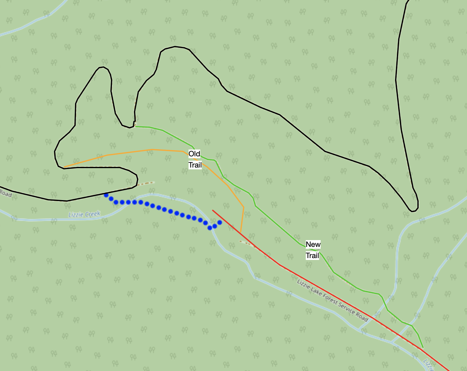
The best choice is the new (2016) bypass trail (above in green) which starts 1.6km up the FSR. It’s a nice, flat, wide trail that provides good walking. Comparatively, the old (2004) bypass trail is much harder and exposed, but it is the first trail you’ll come to so many parties still take it. This old trail climbs and descends steeply and it sucks. For years this was the only trail, so I recommended crossing the creek on logs (or fording it), but the 2016 trail is much nicer and faster, especially if you park up at its entrance instead of the lower parking spot.

In low water, you can ford the creek or cross the indicated logs to go around. The logs work pretty much anytime of year but at high flows a slip off into the raging creek could be fatal. If you are athletic and aren’t parked at the entrance to the 2016 trail, then crossing on the logs can be faster and more of an adventure. I do this in late summer to save a little time. There are some nice old growth trees (some of the last in the Lizzie valley) and calypso orchids on the south side. If you do choose to cross the creek, there’s a nice large log with flagging on it at the upstream crossing that most people will feel comfortable on, although it is a bit high off the water (8′?) so a fall could break a leg. From here you can walk downstream until you see the logging road on the opposite bank and then ford the creek (knee deep) to reach it or cross on a smaller log a bit further yet that can be wet and slippery as it’s only 2′ off the creek.
Once you’ve arrived at the old Lizzie Creek logging road, you basically just follow the obvious path all the way to Lizzie Lake. There are a few old spur roads but they have been long been overtaken by alder (but look like roads mid-winter). It would be possible to bring a bike in – particularly via the 2016 trail – but you’d be pushing it most of the way to Lizzie Lake due to the steady incline in exchange for a fast exit. Sweeter would be an eBike that you could pedal up the incline of the logging road, yet still light enough to toss over the occasional fallen log, and then later rip back out.
The final access point is Texas Creek in the NE corner. I’ve never been up here but it does provide good access to the alpine including the spot where the famous Save the Stein festivals were held in the early 90’s. There is info on this access point on the park website. This access is little used because it’s a long drive to a small alpine area disconnected from the rest of the trail system, but it could a good way to put together an outstanding traverse to other trailheads.
5 – History and How to Experience the Stein
Prior to the 1970’s, the Stein valley saw only light use from the local Nlaka’pamux First Nation as well as a few hunters and trappers. This led to a reasonably well developed trail halfway up the river to Cottonwood Creek but little else. As the showdown brewed in the 70’s and 80’s between conservationists and clear-cut loggers (who wanted to “share” the Stein after they finished devastating pretty much every other valley in southern BC), a flurry of new trails were constructed by conservationists to demonstrate the valley’s recreational value. These trails were hastily cut with little thought put into the actual route and most have disappeared from both maps and the forest. At least 1/2 the trails in Freeman and Thompson (1979) don’t exist anymore and never really did.
 Today there are only a few discernible trails in the park, which are shown above and described at the end. Even these, with the exception of the main valley trail, are best thought of as access tools rather than attractions. The Stryen Creek Trail (officially delisted in 2017 because it crosses private property at the start) and Cottonwood Creek trail (reclassified to a route in 2017 but still reasonable walking) provide access to the southern and northern alpine respectively.
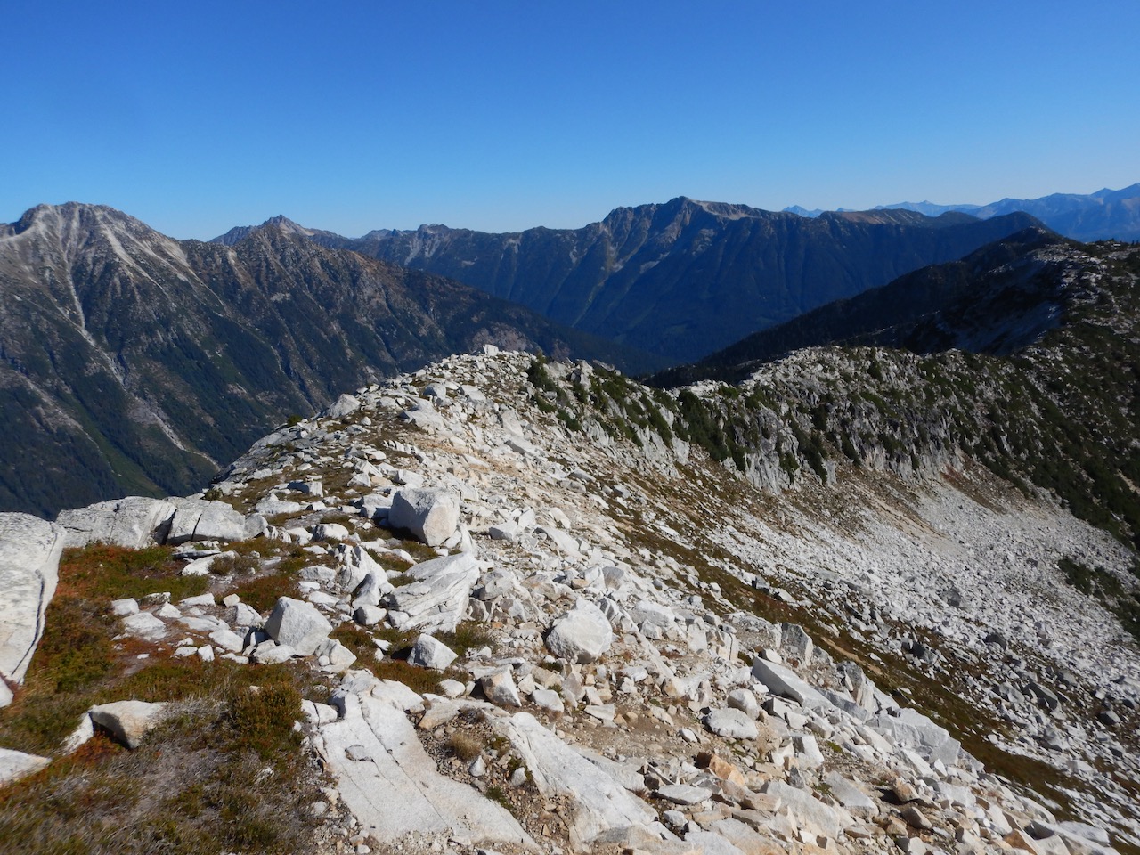
The focus of the guide is on long traverses via foot, packraft or ski. Despite the lack of good trails, these trips are made possible by the Wisconsin glaciation which covered and rounded off most of the alpine ridges but not the peaks in the Stein, making for an alpine that is both outstandingly scenic and surprisingly efficient to traverse. These ridges are a great way to link together peaks, lakes and glaciers.
The best known such walk in the Stein is the “Stein Traverse” which uses the valley trail (57km) to access a great ridge complex through the western alpine (28km) before descending the old Lizzie road (12km) to the west side. Also hiked occasionally is the “mini traverse” which enters from the north and walks the Cottonwood Creek trail into the valley before heading east to the river mouth.
In this guide I’ll comment and describe these trips and offer suggestions on how to best experience them.
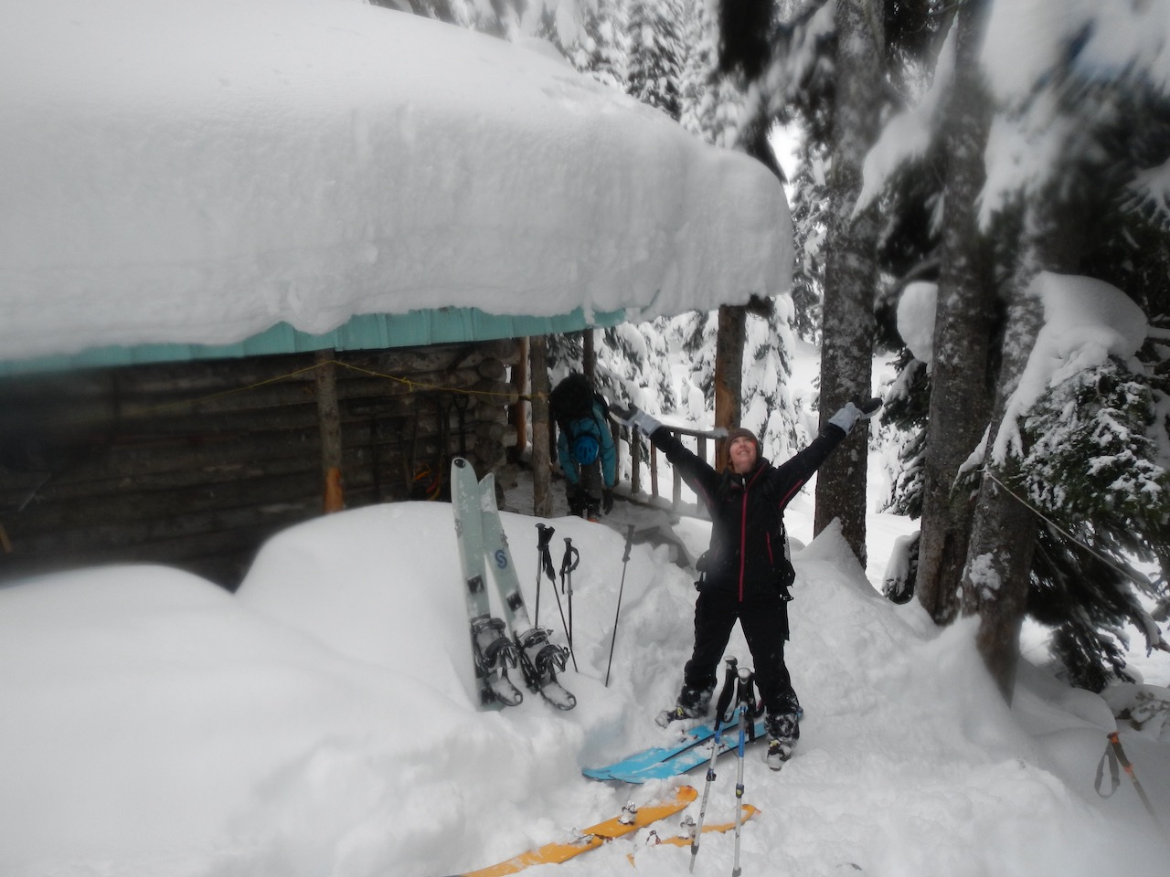
6 – Lower Valley Camping
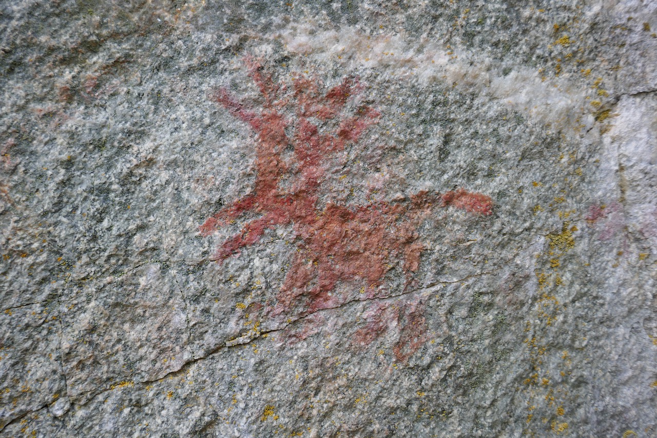
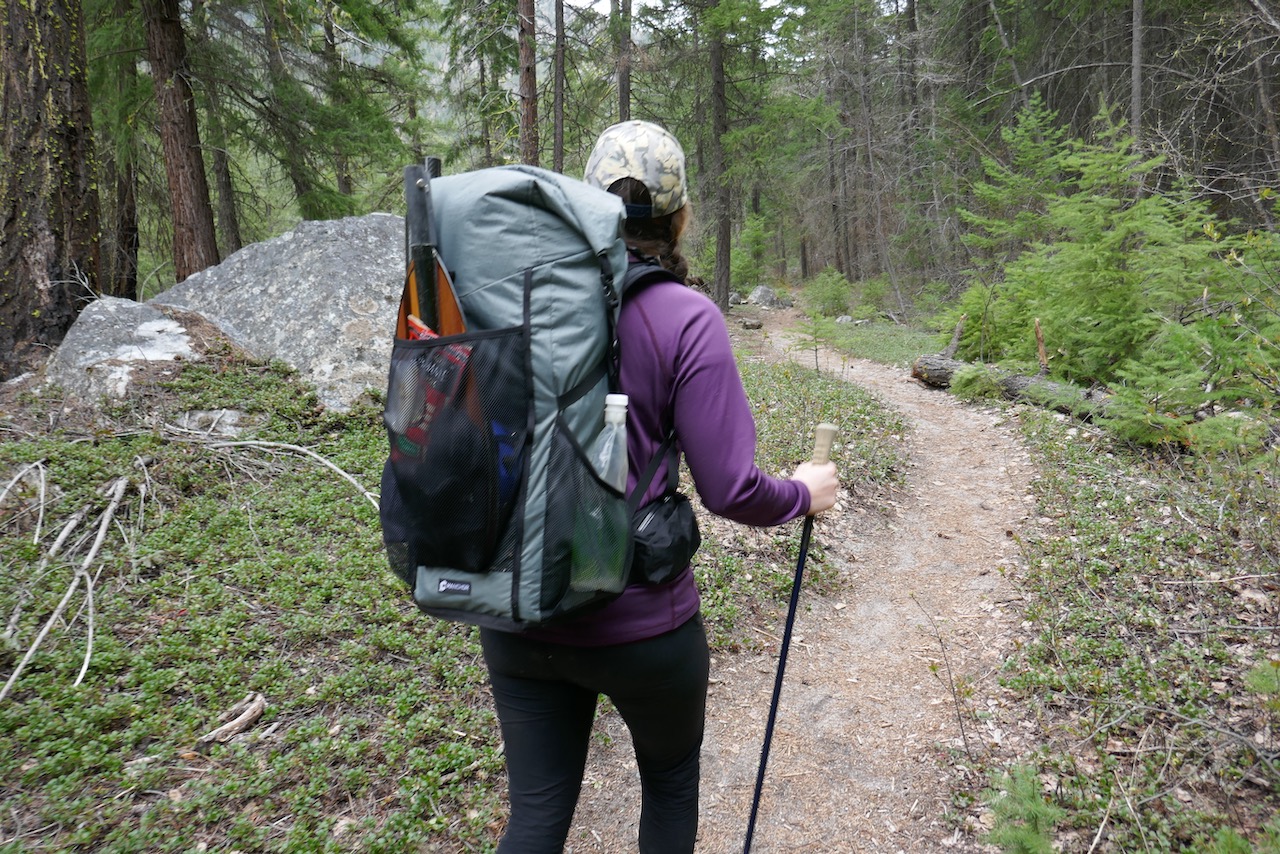
The most popular activity in the Stein in walk in hiking/backpacking in the first 30 km of the lower valley. It’s a great activity, but straight forward stuff so I won’t spend much time on it here. The appeal of walk in camping/backpacking in the lower valley is that the Stein gets nicer weather than the west side of the Coast Mountains – when it’s rainy or snowy in Vancouver it’s usually still nice in the Stein. Thus it is a great spring destination (March – May) and sometimes you can go camping right through the winter. The flip side of this is that it can be extremely hot in July and August. Besides the friendly weather, there is also no fees, a relatively flat trail and plenty of neat attractions including fishing, pictographs and old cabins and caves to hunt out.
 Lower valley camping starts from the eastern (Lytton) trailhead. Most folks stick to the first 13km, where there are frequent campsites (every 2-4 km) with outhouses and bear caches (unreservable, no fees). Walk as far as you please, camp and hike back. The campsites are Loop Camp (km 2.5), Devil’s Staircase (km 4.5), Teepee (km 8), Earls Cabin (km 10) and Suspension Bridge (km 13). Beyond the Suspension Bridge the trail isn’t quite as good, but it’s still nice walking to Cottonwood (km 30). There are many areas when you can camp in this section as well, but the official sites are Lean To (km 17), Ponderosa (km 22) and Cottonwood (km 30). See the trails description section for further info.

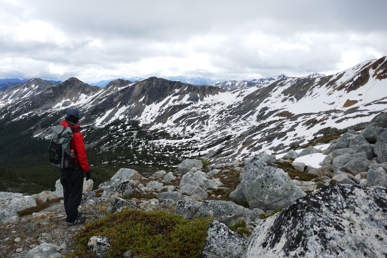
7 – Commentary on the Stein Traverse
In various venues the Stein Traverse is described as either the ultimate wilderness experience, or a horrific slog. What it really is (from east to west) is 15 km of pretty good trail, 42km of mostly poor-okay trail with a few nice spots, 28km of incredible alpine and then a 12km green alder tunnel down an old logging road. For more details, see section 9 (trail descriptions). The traverse is a great trip but almost entirely due to the alpine and adjacent lakes (Stein, Lizzie). If you can’t handle some – or a lot – of suffering, you won’t like it. Those who are happy to accept below average trail for a more remote experience will be delighted.
With that said, major trail work was done in 2016 and 2017 and this substantially improved the main trail. The worst part – the alder covered burn zone from 2006 around Avalanche Creek – has been vastly improved, and the entire valley trail was cleared of deadfall (of course some more has since fallen). Even the stretch of trail rising from Lizzie Lake up to Lizzie cabin was cleared of it’s formerly substantial deadfall and is now in pretty good shape with only a handful of big logs down. A windstorm in fall 2016 did add a moderate amount of new deadfall to the trail, but overall the trail is WAY better than it was prior to 2016.
The traditional suggestion for the Stein Traverse (See G. White’s guidebook) is to start from the west, which I disagree with. Starting from the west is easier in that you gain elevation gently on a former logging road rather than a steep trail up from Stein Lake. It also lets you have a recent weather forecast for the exposed alpine section. The downfall is that you see all the best terrain in the first 40% of the trip. The valley trail isn’t terrible, but it can seem that way if it has to follow the high bar set by the alpine.
So I recommend starting from the east. In doing so, you’ll gain a wilder feel in the alpine since you’re probably 4-5 days in before you even start the ascent. The remote upper valley trail will make the trip feel wild even before you’re amongst the peaks. This gives the trip it’s zenith on the penultimate day and leaves the logging road descent as a time for reflection. You’ll appreciate the easier walking. It also lines you up for incredible post trip eats in Pemberton at either the Pony or Mile One Eatery, rather than the limited fare served in Lytton. It’s also worth considering starting at Blowdown/Cottonwood on the north side instead of Lytton. This adds a bit of alpine to the trip and most importantly, can make the logistics/shuttling quite a bit quicker. Even better is the “Angel’s Traverse” which is described in the final section of this guide. That trip walks the ridge between the Cottonwood and Scudamore valleys, and roughly doubles the alpine on the traverse.
The main criticism of the Stein Traverse is that the effort is high relative to the alpine it crosses, which some of my trip suggestions seek to improve. Both the length and difficulty of the access are substantial, so you have to enjoy this sort of semi-suffering adventure. If you do, check out the detailed trail/route description for this traverse in section 9.
My suggested itinerary for the Stein Traverse is:
Day 1: Sort logistics, start mid day at Lytton (yes it’ll be hot) and hike 13-14km of easy trail to the suspension bridge camp or Riverside camp just beyond.
Day 2: Hike to Cottonwood Camp (km 29) or Logjam camp (km37). The latter isn’t nearly as nice, but it lines you up to camp at a nice spot on the river tomorrow and then more time at Stein Lake on day 4.
Day 3: Hike to Avalanche Camp (km 47, good camp) from Cottonwood or to a nice unofficial river side camp (km 52) just prior to the upper cable crossing if you were at log jam.
Day 4: Arrive at Stein lake (km 57, mediocre camp), relax and go fishing.
Day 5: Stein Lake to Puppet Lake (or Tundra Lake in a big day)
Day 6: Puppet to Caltha Lake (if you were at Tundra, also bag a peak en route)
Day 7: Caltha to Lizzie Cabin (fairly easy, bag a peak on white lupine ridge)
Day 8: Lizzie Cabin to Finish.
8 – Commentary on Mini Traverse
The “mini traverse” starts from the Blowdown FSR on the north side, heads over Blowdown pass and walks 30km south down the Cottonwood valley to meet the Stein River at its midpoint. At the river, it follow the valley trail east 30km to the river mouth.
The main advantage of this trip is that you park at a high elevation (1650m/5400′) leaving just 550m to the pass, beyond which everything is downhill.
The downside of the mini traverse is the alpine is limited and over quickly. The 1 hour / 3 km section over Blowdown pass is the extent of it, and even this is sullied by the old mining road which demonstrates just how slowly scars heal in the alpine. For this reason, walking the “Angels Walk” ridge (which divides Cottonwood and Scudamore valleys) instead of the parallel Cottonwood trail makes for a vastly better trip than the standard mini traverse. Much better still would be turning west when you reach the Stein River to hike the bulk of the main traverse, rather than the shorter exit east to Lytton.
You can hike the “mini traverse” in either direction, but starting in the North is easier because it gives a downhill trip, and because navigation going out of the Cottonwood Valley is easier than going in. This trail used to be rough, but it was cleared in 2010 and the southern half was cleared and remarked again 2012 after it burned, so it’s actually pretty good walking except for the last 2km down to the river. This last 2km is talus slopes with occasional cairns and trail makers, but no obvious trail when I was there. However, trail work in 2017 supposedly modified this route so it is more obvious and also re-routed somewhat so it reaches the Stein river a bit further east from Cottonwood Creek. If you’re hiking south you may lose the trail as you descend the talus slopes to the Stein River but it’s no problem because you’ll intercept the valley trail eventually. If you’re hiking up from the river you may have a tougher task sleuthing out the occasional marker and cairn until you’re out of the main river valley, unless the 2017 trail work was a big improvement. Once you are a top the talus, the trail becomes obvious. The Cottonwood Valley is rarely visited, but it’s a neat area that’s worth heading into.

Where the two forks of Cottonwood Creek meet is a reasonably developed campsite (picnic table, bear bin). It’s the only such camping area in the Cottonwood drainage until the creek mouth, but there are lots of other areas you could set up a tent. A reasonable southbound itinerary is to hike to the forks of Cottonwood Creek on day 1, Stein River on day 2, the suspension bridge on day 3 and finish on day 4.
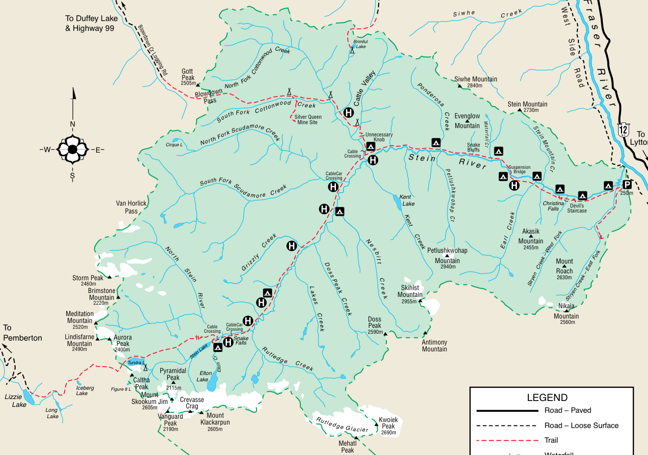
9 – Stein Trails Description
There are only three marked trails in the Stein, as shown above. The main valley trail runs east-west across the park. The Stryen Creek trail is the short trail on the eastern side, while the Cottonwood Creek trail splits off from the main river trail mid-valley and runs northwest over Blowdown Pass until it hits a driveable logging road in north of the park along Blowdown Creek.
MAIN VALLEY TRAIL
From the parking lot on the eastern side of the park, the trail begins on the south side of the river. The first 13km to the suspension bridge is good walking, although quite hot in mid summer. “Devil’s Staircase” is no such thing, as it’s an easy 5 minute climb, although the ups and down for the next 2km do get a bit tiresome. Good camps are found every few kilometers. There’s Loop Camp (Km 2), Devil’s Staircase (Km 4), Teepee (Km 8), Earl’s Cabin (Km 10) and the Suspension Bridge Camp (Km 13). This section is the highest used area in the park.
Just after a nice camp at km 13 the trail crosses to the north side of the river via a suspension bridge and remains good walking for another 2km. In this section there’s another nice camp spot (“Riverside”) with a tree platform but no other amenities. After this point, the trail sees less use. From km 15 to the Ponderosa Shelter (km 21) the trail is a mix of good forest walking and mildly brushy walking near the river with alder, rosehips and horsetail. Camping at the Ponderosa shelter (built 1972) is a bit gloomy, as the shelter is run down. The actual Ponderosa camp is 5 minutes further across the creek and is nicer. The trail itself currently skirts the Ponderosa shelter, so you might miss it entirely, which is fine.
From Ponderosa, it’s 8km to Cottonwood Creek (km 29). This section is more of the same half brushy, half good walking with some talus thrown in, until the last 3km, which is fast forest walking. There used to be quite a bit of riparian trail that was rather brushy, but most of these sections were re-routed in 2016 so the walking is generally better. The only exception is a few talus fields, where the trail disappears for a few hundred meters and you need a keen eye to follow the cairns.
When you arrive at Cottonwood Creek there is a nice camping area, a fire ring, map and an outhouse. It’s a good spot to camp. Cottonwood falls is worth the 5 minute hike upstream. The actual trail up the Cottonwood valley starts a minute back at the signed junction. Cross Cottonwood Creek via the bridge just downstream of camp (the cable car has been removed). While this bridge is old, it’s due to be replaced and even if it gives out before that happens, fording wouldn’t be hard.
After Cottonwood Creek, the trail is mostly good walking but can be overgrown with Fireweed if you’re one of the first parties through that year. The fireweed won’t slow you down much. Cross Scudamore Creek around km 33 via the new cable car and then arrive at Logjam camp (km 37.7). The logjam is neat, but the camp itself isn’t anything special. Feels a bit gloomy to me.
For the next 7km the trail follows the river. It’s decent walking although there will be some trees down and some fireweed sections. Only full traverse hikers make it this far, and there’s probably only 30-50 of them per year, so it’s not a well worn footpath. Thanks to recent remarking and maintenance, it’s not hard to follow like it was prior to 2016.
Around km 44 the trail climbs away from the river until km 51. This area burned in the 90’s and was extremely shrubby by 2015, but is now far better. It’s still a bit slow and can be quite hot as the valley wall gets a lot of sun exposure, but it’s not too hard. You should be able to do 2.5 – 3km/hr with a moderate effort.
In this section, some maps show a few camps but only “Mid Canyon Camp” aka “Avalanche Camp” (km 47) just east of Avalanche Creek really exists. It’s a nice beautiful spot with a great view, outhouse, heli pad and bear locker. Water is 2 minutes further west at the creek. I’ve camped here without incident, but this spot is notorious for packrats nibbling on gear so watch your stuff. It’s often referred to as “Packrat camp”. If you can manage, going another 5km to camp at the river (km 51) is better.
After Avalanche camp the trail skirts the side wall for a few more moderately tough kms before descending a talus field to the Stein River (km 51) and from here the walking is good to Stein Lake. In the next few kms are several incredible stands of old growth Douglas Fir and Cedar. There is a beautiful camp spot along the river just before the upper cable crossing (km 52) and then it’s more good walking to Stein Lake. There’s only one camp area at Stein Lake just after the cable car which holds 2-3 tents, so don’t look around too hard for something more substantial. You can walk along the south shore if you want to do some fishing (Rainbow Trout!).
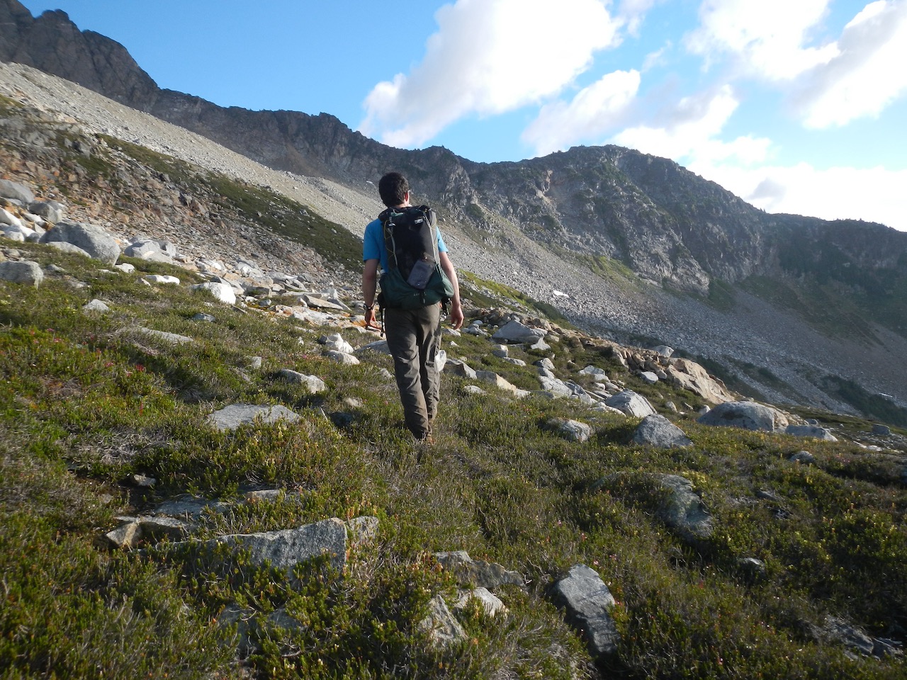
From Stein Lake, cross the outflow via the cable car. Don’t even think about following the north shore of the lake and ascending the outflow from Puppet Lake as some guides suggest. It can be done, but it’s way slower, harder and tougher and you’ll miss some great alpine. Instead, follow the main trail east for a while until the ascent to the alpine begins. This section of trail could use some work as there are trees down and eroded spots, but the trail condition aren’t a big deal relative to the challenge of the 1200m climb, which is steep and often a bit loose. Ascending isn’t too bad, but you’ll likely land on your butt once or twice if descending.
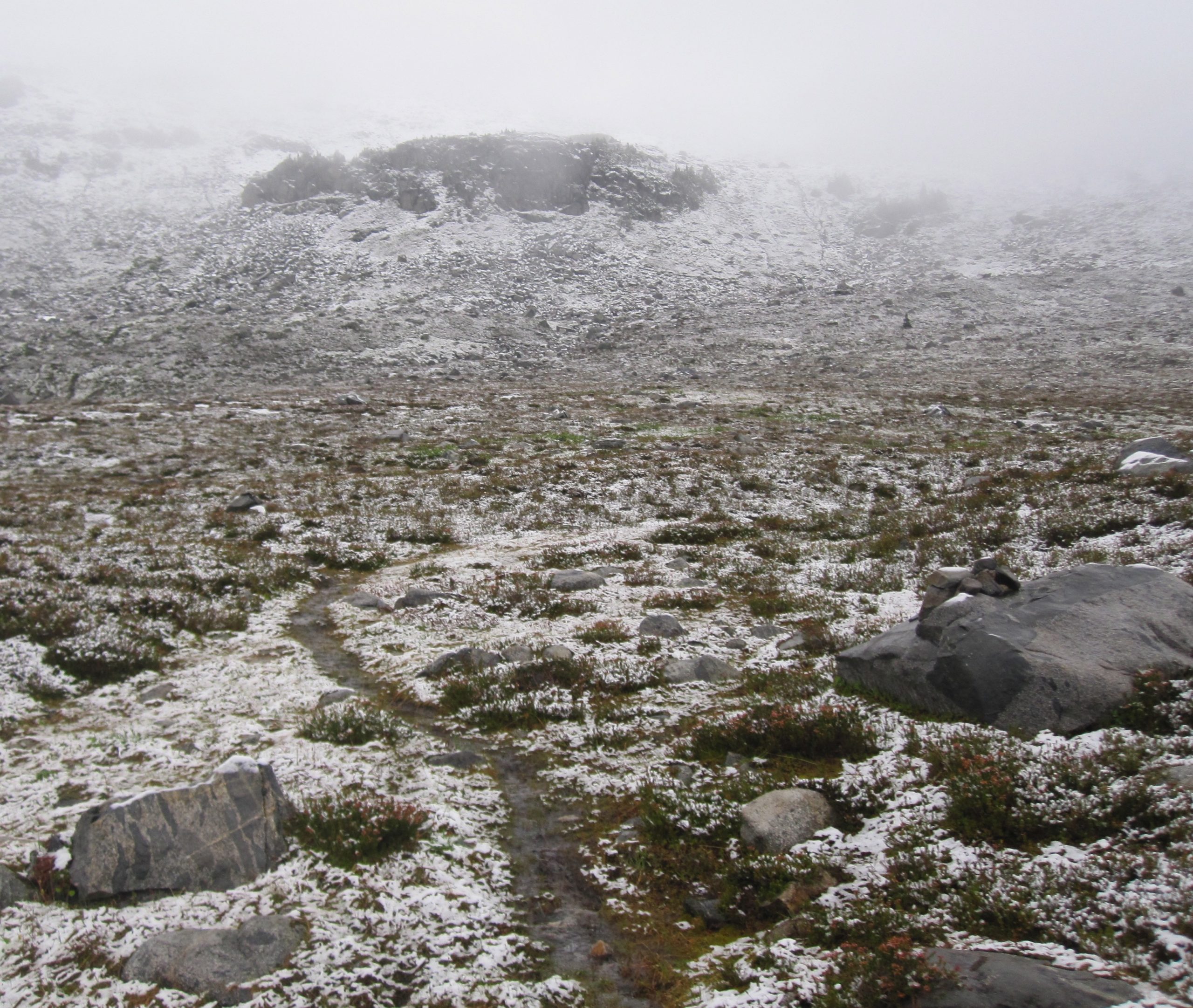
Shortly after you reach the top, the trail markers end. The rest of the route is now unmarked until Lizzie Cabin except for hiker built cairns, which are frequent. Feel free to add some if you’re confident that you’re on route. The footpath is pretty well worn in the alpine so despite the lack of markers the route is usually easy to follow. The exception to this is for eastbound hikers trying to find the marked trail to descend to Stein Lake from the alpine. This can be tough, as the markers are sparse and faded near the ridge, while the trail is eroded and vague and over the years hikers have worn in many faint paths. Be attentive as you near the end of the ridge for faded markers.
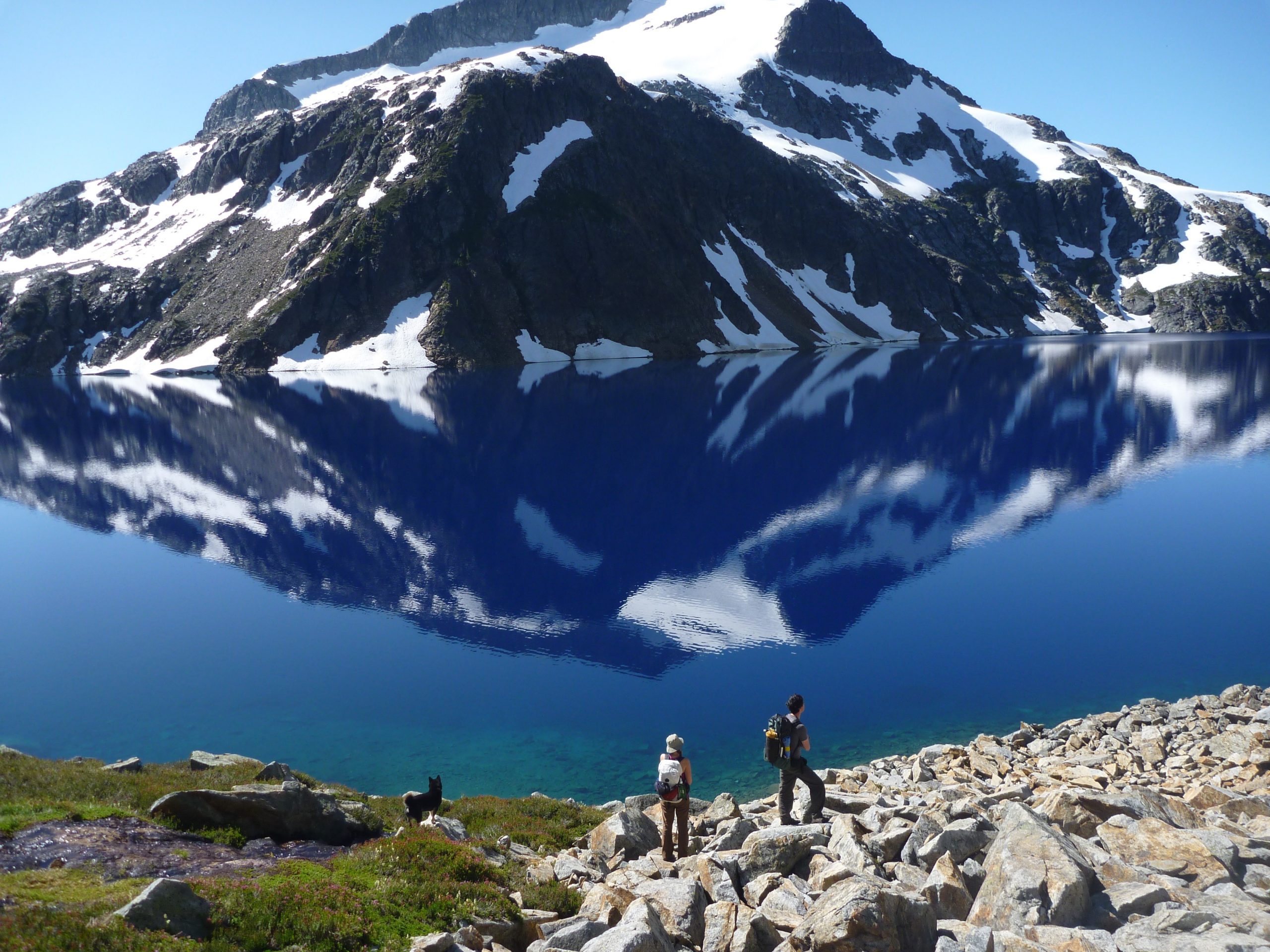
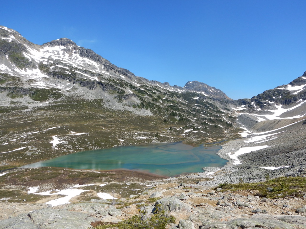
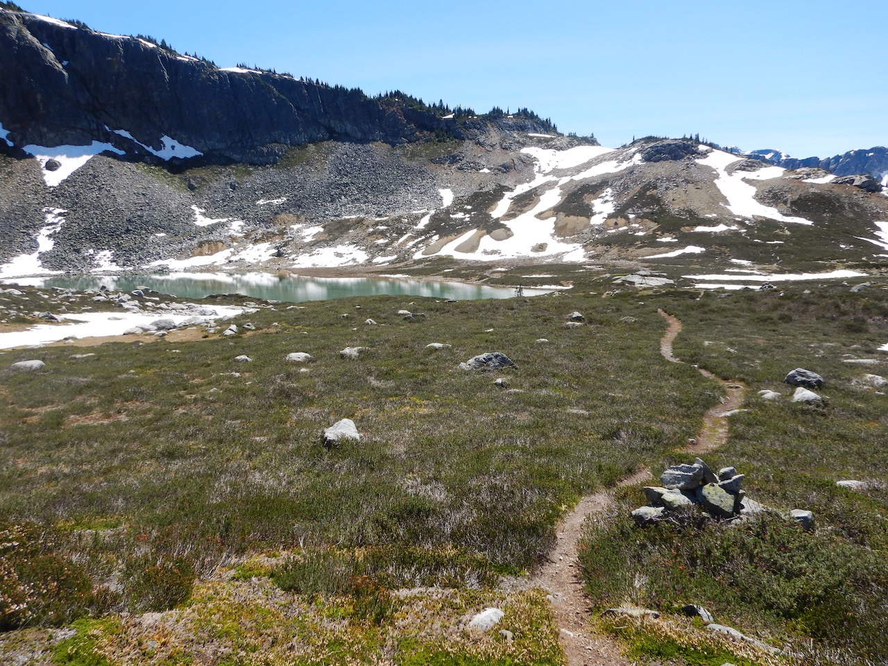
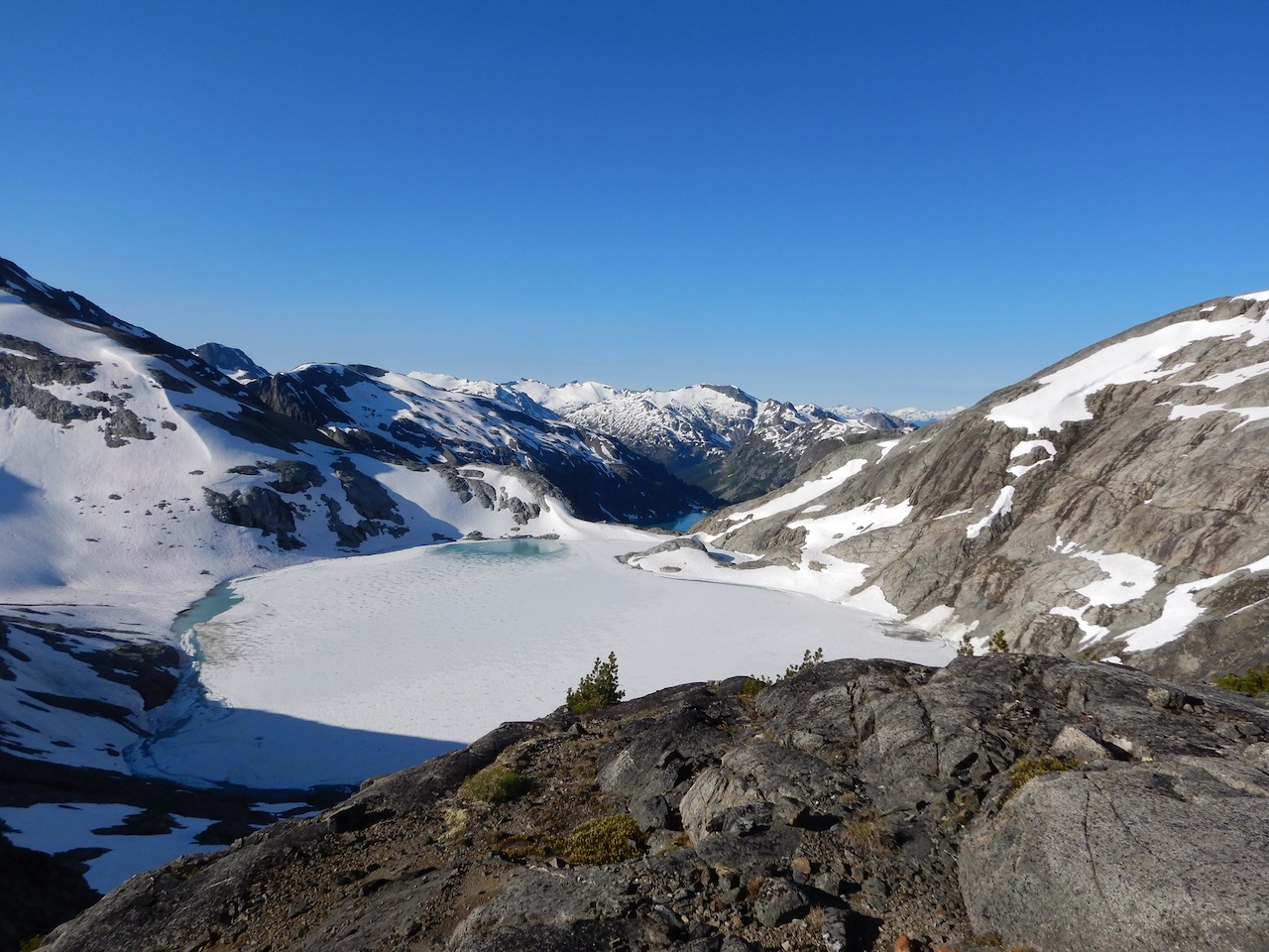
The ridgewalk to Tundra lake is spectacular and slow but straightforward walking once you’re on top. Water is scarce if the snow has all melted but usually there are still a few snowbanks in late August. The longest lasting snowbank lies on the east side of the ridge just before you leave the ridge near Tundra Peak.
Half way to Tundra is the option to descend to Puppet lake (south of the ridge) for water or camping. There are also two lakes on the North side of the ridge that look equally appealing but they’re a little further down. A proper camp site now exists at Puppet, so it’s a nice spot to stop. The alpine section is superb, so if you have the time I suggest stopping at Puppet to stretch it out.
The trickiest part of this section is getting off the ridge when the time comes to cross the east face of Tundra Peak over to Tundra Lake. I’ve never found a good way of doing this. You’ll be walking along the nice ridge and able to see Tundra Lake from here, but there won’t be an obvious way to get off the ridge down to the talus filled bowl you need to cross. As you continue along the ridge, the trail just gets fainter and fainter since more and more folks have bailed off. Some maps show the route continuing on the ridge right over Tundra peak itself, but this option is usually quite snowy and I haven’t tried it.
My advice to is not to bail off too early, but wait until you’re near the talus in the main bowl. You should be able to scout a decent line that “goes” from the ridge to the bowl, and then bail off the ridge using the numerous Krumholtz trees for hand holds. Some people will find the 50 foot down scramble a bit terrifying but it’s not ridiculous. As far as scrambling goes, this is minor. So in short, bail off whereever it looks reasonable once you’re beside the rocky bowl across the SE face of Tundra Peak.
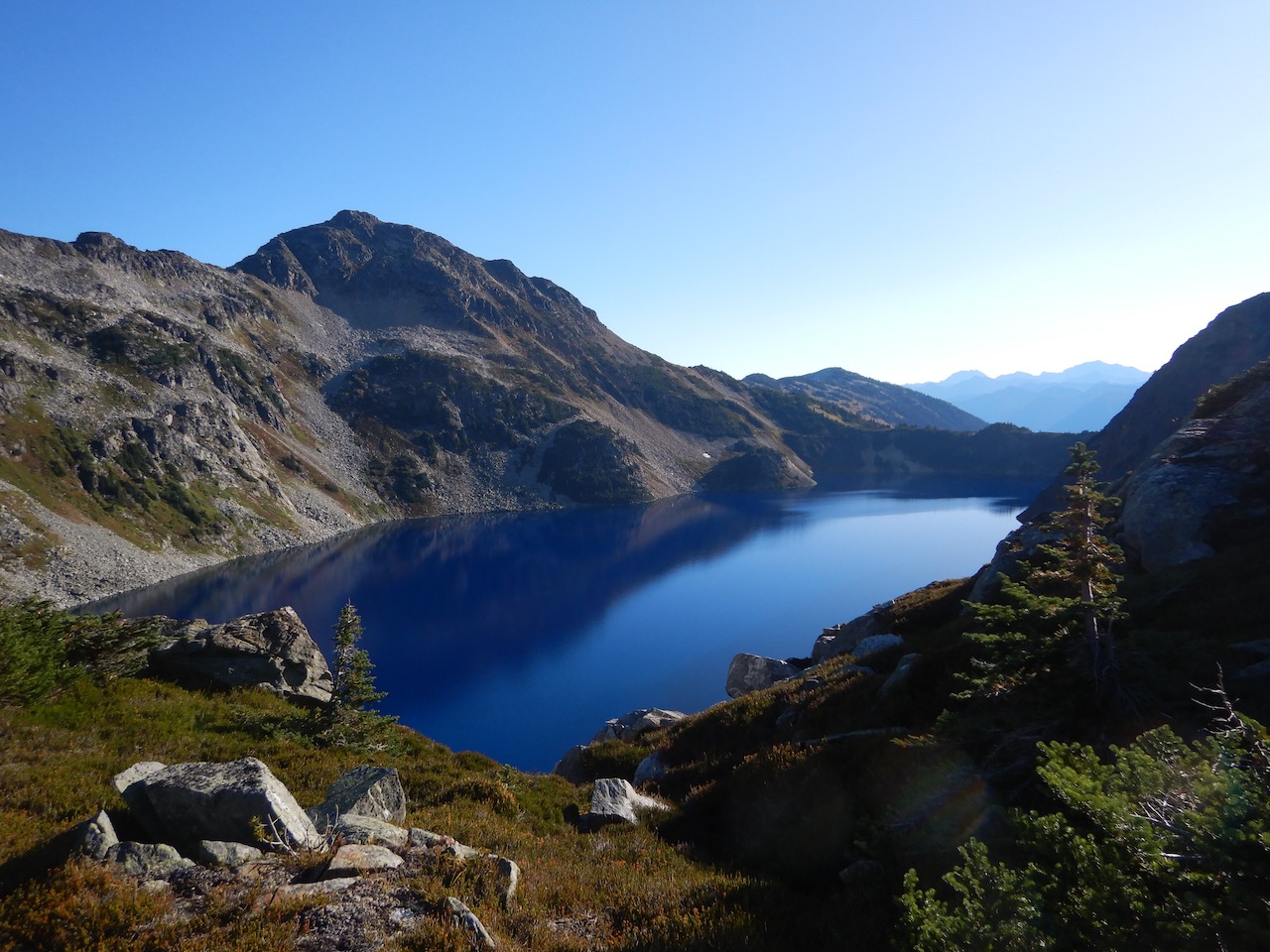
Once off the ridge, it’s an easy contour across the talus bowl and over the far ridge, behind which lies Tundra Lake. The main camp spot was originally near the outflow, and then later on first big knoll on the North side of the lake, but it moved back to the outflow in 2017. It’s slightly off route, but it’s the best spot to camp. The an amazing spot with better camping and an outhouse. Tundra lake is awesome. Go for a dip.
To get from Tundra Lake to Caltha Lake most folks will boulder hop the north shore of Tundra Lake and go over the pass behind the lake, but it is also an option to cross the outflow of Tundra Lake and circle around Caltha Mountain itself, past Figure 8 lake, to reach Caltha Lake (not shown). This route is gorgeous but longer and harder to navigate. It’s basically an alpine wander from Tundra to Figure 8 lake, and then a surprisingly good trail runs from Figure 8 to Caltha Lake. This route is actually a better way to go in my opinion, but it is a bit longer. Most folks will stick to the north shore of Tundra Lake.
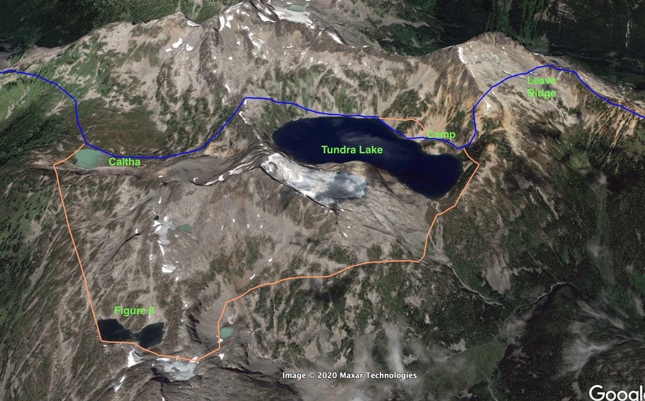
There aren’t very many cairns along the North shore of Tundra because the talus is so large they are hard to spot anyways. The route is shown above. A key point to note is that the normal route goes above the large knoll about 1/3 of the way along the shore (shown in orange) but it is easier to go below if you’re spry enough (e.g. light pack) to navigate a few tight spots along the lake edge (worse case scenario is a wet boot). After this knoll, you want to stick to the shoreline until you are near the far end of the lake, at which point you ascend gradually to the pass. It might be tempting to stay high after the knoll (if you go over), but this means a lot of side-hilling on usually slick vegetation. It’s inefficient and there’s a much higher chance you’ll slip and break a pole or ankle. So descend to the shore and don’t climb until just before the cliffy bluff.
Once you’re over the pass, Caltha Lake is obvious and a faint trail with cairns resumes.
The route from Caltha Lake to Lizzie cabin is difficult to describe but fairly obvious except for the talus sections, where cairns exist to get you through. We stayed on route following cairns even during a snowstorm in August 2010. This section has more great scenery. You can camp halfway on White Lupine ridge in nice weather, but it’s only 3-4 hours from Caltha lake to the cabin.
From the cabin there’s an obvious trail down to Lizzie Lake. It had some big logs down on it that were acrobatic to scramble over, but nearly all of this has been cleared as of 2017. Lizzie Lake is loaded with cutthroat trout. It’s unbelievable. From Lizzie Lake, follow the semi-brushy logging road for a few hours and you’re done except for the last creek washout section, which was described in detail under the access section. In short, take the flagged trail on the right (north) side of the old road about 1km before you arrive at the washout.
10 – Packrafting
The Stein River is the only packraft suitable waterway in the valley. There are many side creeks, but they are all too small, too steep, choked with wood or all of the above. As far as I can tell, no one has ever packrafted the entire Stein River but folks have kayaked the Stein River after either illegally chartering a plane to Stein lake, or by commendable fair means of lugging Kayak’s over Van Horlick pass and paddling the class V-VI North Stein to the main river.
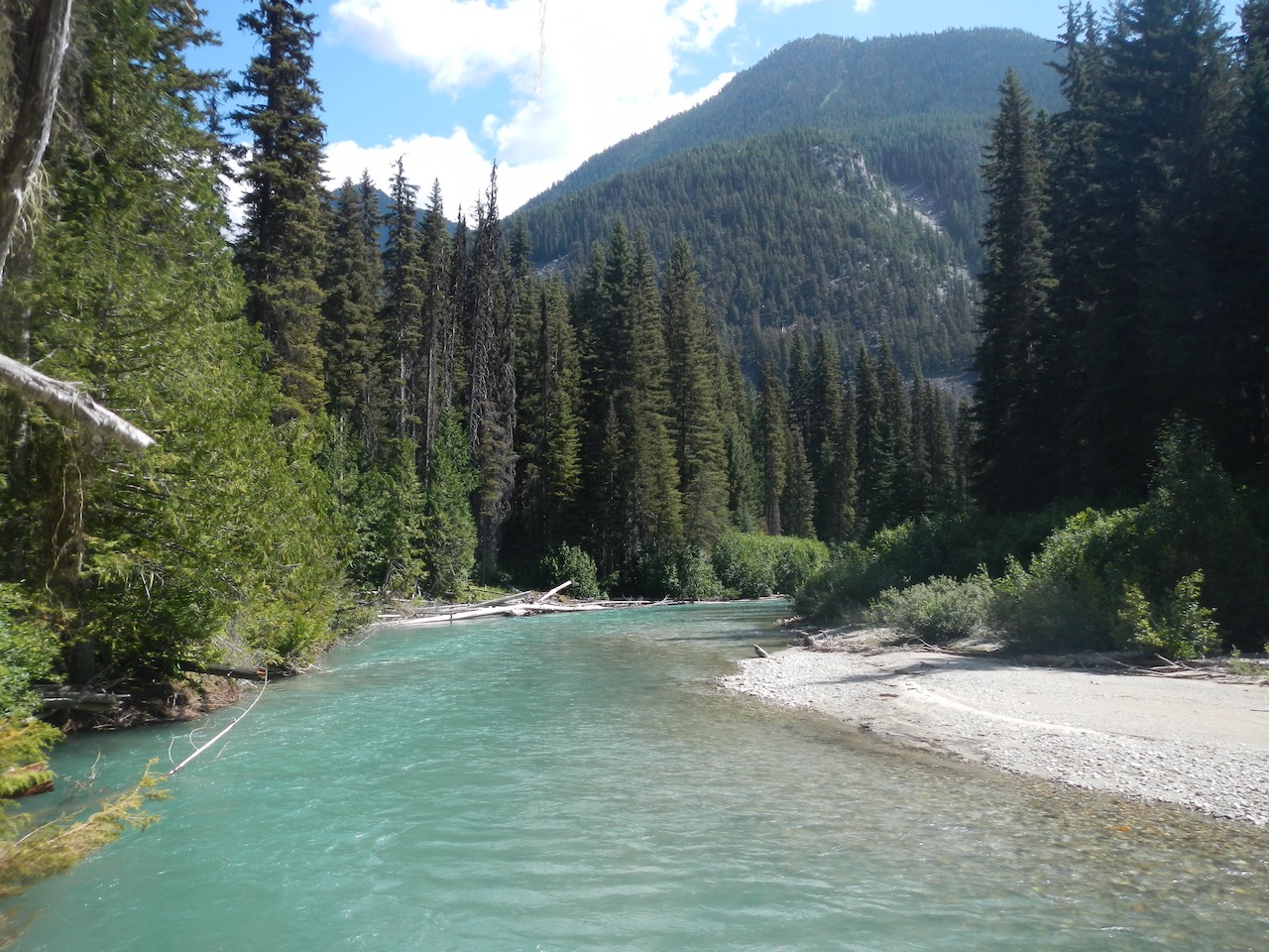
One of the neat attributes of the Stein River is that it changes color each year, from clear water in the winter to teal each summer, as the glacier melt contributes more of the water.

The Stein River can be divided into three parts: the upper, mid and lower river. The upper river starts at Stein Lake but it choked with wood until the North Stein tributary feeds in 1.5km downstream. The next 10km have a few large rapids including “Snake Falls” 2.5km from Stein Lake. At first these rapids are inter-mixed with flat water, but after ~5km they become continuous, harder (IV-V) and difficult to escape in a canyon. The best beta on this is here. Only expert paddlers should attempt this section. At this point the hiking trail is high on the north wall, so you are largely committed to the river. The curious and advanced paddler could try a few of the rapids between where the North Stein feeds in and the upper cable car (6km downstream from Stein Lake) but should take out at the cable car.
The middle Stein begins where the valley trail re-joins the river about 13km from Stein Lake and 44km from the river mouth. Here the river changes character dramatically and becomes largely class I water with maybe some class II sections. You can put in as soon as the valley trail reaches the river (near “Raven Camp”). The middle Stein section runs 31km and is nice floating with great fishing spots and few concerns.
The only consideration is wood, which is an on-going concern but the river is mellow enough that it is easy to handle. There are two massive log-jams in the first 10km, which are a bit of pain to portage but easy to see coming. The latter log jam is at Log Jam Camp where the trail is close to the river, so you can intercept the valley trail on the north side to portage. The beavers like to drop cottonwoods on to the river each fall, so they have food for the winter. The spring high water usually pushes this wood out of the way, but there will be a few logs across here and there each year.
The 15km from Raven Camp to Cottonwood hasn’t been packrafted (as far as I can tell) but figure on about 5 hours of floating with a moderate paddling effort and a few portages. I floated the next 8km (Cottonwood to Ponderosa) in 2.5 hrs in fairly low flows in April. It’s all Class I water except a few riffles that might go class II in high water. We easily portaged 6 logs it this section – most of which were single logs that would likely be cleared in May-June, so an July-August float would likely have less.
We found less wood from Ponderosa to Riverside and floated this 7km in 1.75 hrs. Just before Riverside the river starts to change character. There is a horizon line that indicates a short boulder garden (Class II) followed by a similar boulder garden 2x as long. After this, there is a another 1km of faster riffles until the serious water starts at the suspension bridge. An easy clue to take out is the cleared helicopter landing spot about 0.5km above the bridge, but there is also a good take out right at the last meander before the bridge.
The lower Stein is 13km of continuous class III-V boulder garden. I haven’t run it personally, but it’s highly regarded in the white water community. The first 6-7km are continuous class III boulder garden. The rapids get a bit more serious (class IV) about 2km before Devil’s Staircase camp including one supposed class V rapid. After Devil’s staircase the river resumes Class III down to the confluence with the Fraser.
Flows are typically moderate in April, high in May-June and then moderate through the rest of the summer. There is enough year round snowpack and glaciation to keep good water flow right through the summer. Based on the historical data, there is always enough flow to paddle the middle Stein, whereas the boulder gardens in the lower Stein would be problematic at low flows and pushy at high flows.
There is no gauge on the Stein, so the best reference point is this gauge on the Nathatlatch River (one valley south). When I floated the middle Stein in April the Nahatlatch gauge was at 1.1m (water level) or 25m m3/s (discharge), which was plenty. Flows peak at about 2x in the May-June. A rough guess would be 0.6 – 2m would be fine for the middle river, while 1.5m might be ideal for the upper and lower sections.
11 – Suggestions for Outstanding Trips
This section goes beyond the great hiking trails in the Stein and speculates – perhaps a bit too exuberantly – about more ambitious trip. The Stein contains so many great ridges and lakes that it’s impossible to list all the great trips that are possible. Here I’ll try to provide a sampling of different options that I think have high potential, but keep in mind that almost every ridge in the Stein is walkable if you have the right attitude and experience, so the possibilities are endless. None of these trips are suitable for beginners or intermediate wilderness travellers. To pull any of these off you need strong navigation skills, bear knowledge, moderate comfort scrambling, good fitness and a level head.
A) Angels Traverse – 95km, 6-8 days.

The ridge between the Cottonwood and Scudamore drainages was named “The Angels Walk” by the late Father Damasus (1921 – 1978), who played a large role in saving the Stein. It’s purported to be an outstanding ridgewalk. I haven’t personally walked it, but I did gaze at it while skiing the Cottonwood trail. In addition to good walking and 360 views, this ridge offers a great look at both Petlushkwohap (9642′) and Skihist (9738′) peaks on the opposite side of the valley, which are the highest two peaks in southwestern BC.
This ridge is a far more scenic option than the Cottonwood trail, so it is a great way to spice up the mini traverse, or it can be linked in with the main traverse as suggested here to form a trip similar in length to the Stein Traverse, but with double the alpine. The car shuttle is also hours shorter. To my knowledge this trip hasn’t been done (Edit: A crew has now completed this route and in an impressive 3 days. See their report here) .
There are several ways to gain this ridge, two of which are recommended and thus shown in the route sketch. The path of least resistance is to follow the road over Blowdown pass (above) and into the Cottonwood valley. After ~5km the road appears to end and a trail continues, but actually the old road crosses the creek here and heads up towards the old Silver Queen Mine just below the ridge. You can also head up here to the end of the road in the alpine and from there, use your best judgement to gain the ridge.
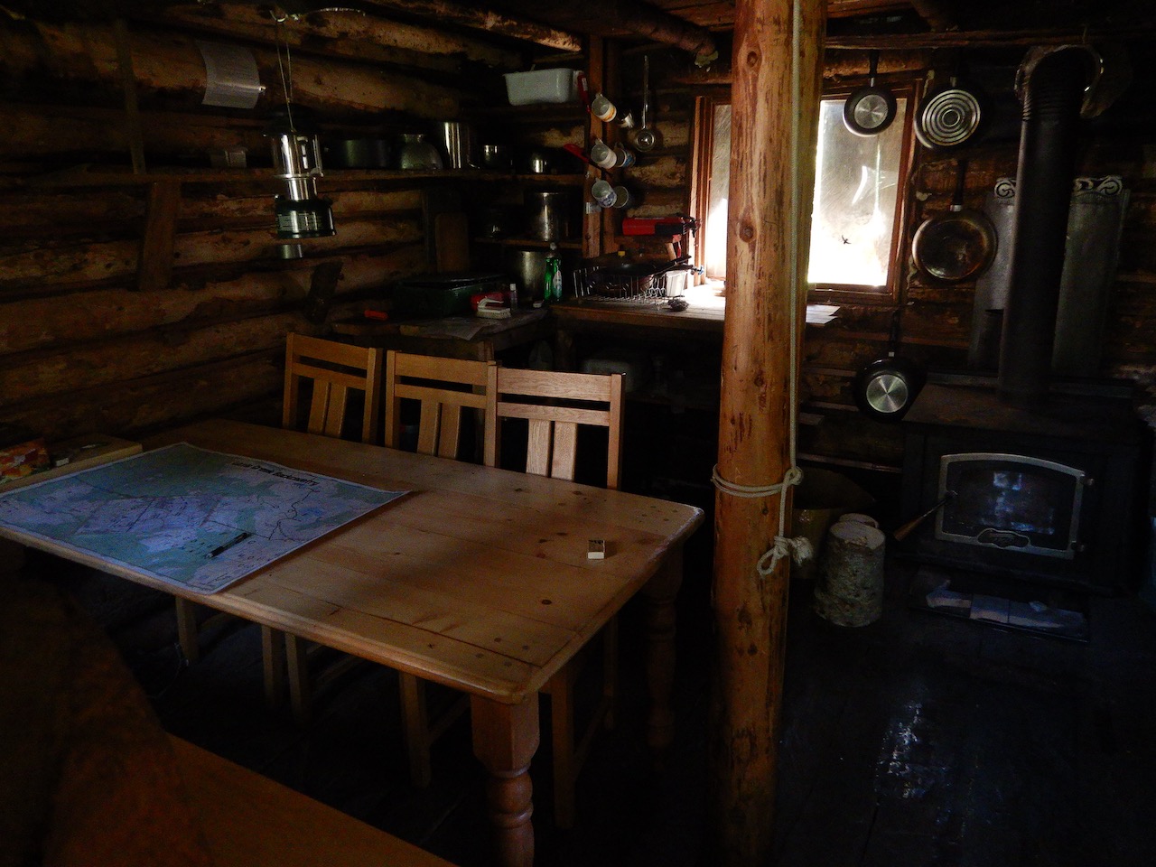
A better option to gain the Angel’s Walk ridge is to hike the trail to Blowdown Cabin at the headwaters of Blowdown Creek (not near Blowdown Lake) and wander through the alpine from there. This would take only a little longer and is substantially more grand, as it stays entirely in the alpine and avoids walking on the old road. Blowdown Cabin is a nice but unsanctioned cabin built on crown land. I’ve indicated the cabin on the map above. I won’t delve the co-ordinates here, but the interested can easily spot it on Google Earth. To get here, the Trail Ventures map shows two trails – one on each side of Blowdown creek – but only the trail on the NW side actually exists. It is a good trail and takes about 1.5 – 2 hours to the cabin.
Snowmobilers use Blowdown Cabin in the winter (it has a wood stove) but only the occasional hiker uses it in the summer. From Blowdown Cabin to the Angel’s Walk ridge, the Trail Ventures Map again shows two routes with one better than the other. The tough route scrambles right over Notgott Peak, while the more sensible one treks northeast of Notgott peak via a saddle (shown below). I’ve only done the latter and it’s a good way to go. The route right over the peak looks like some serious scrambling on the backside and likely not suitable for most folk, although perhaps it is easier than it looks. ITMB left it off their map.
Once on the ridge, there are a few spots you can bail off to camp, such as the small lake at the old Silver Queen mine. Otherwise stay on the main ridge until you reach the final descent to the Stein River. You can descend pretty much anywhere on this face so just head downhill, except be careful not to get too far east and sucked into the canyon that Cottonwood Creek goes through. Descend until you intercept the valley trail. This descent is mostly open, dry pine forest so you’ll have good views to macro-navigate to the river. The valley trail isn’t super obvious as the fireweed can be thick in the valley if you’re there before most hikers go through in August, so pay attention, although you’ll soon hit the river if you miss it. From here turn west and follow the Stein Traverse route description.
A good plan for this trip is:
Day 1: Sort logistics, arrive mid-afternoon and hike to either Blowdown Lake or Blowdown Cabin.
Day 2: Hike to small lake at Silver Queen Mine
Day 3: Walk ridge to Cottonwood Camp
Day 4: Camp at the Upper Cable Crossing along the river
Day 5: Camp at Stein Lake. Go fishing.
Day 6: Big day on ridge to Tundra Lake
Day 7: Tundra Lake to Lizzie Cabin (or split this up)
Day 8: Lizzie Cabin to Finish
B) Packrafters Traverse – 95km, 6-8 days

Packrafting provides a way to hike the best parts of the Stein Traverse and then float out large sections of the river instead of walking the valley trail. Follow the itinerary for the Stein Traverse (but from west to east) but put in where the trail rejoins the river above Log Jam camp, or sooner if you’re an expert paddler. Beginner – intermedate paddlers should take out above the lower suspension bridge, while advanced paddlers will enjoy the last 13km of boulder garden.
Casual and cautious itinerary:
Day 1: Sort logistics, get to Lizzie Creek FSR before noon. Hike to Lizzie Cabin
Day 2: Lizzie Cabin to Caltha Lake
Day 3: Caltha to Tundra Lake
Day 4: Tundra Lake to Stein Lake (or layup at Puppet Lake)
Day 5: Stein Lake to Avalanche Creek Camp
Day 6: Avalanche Creek to Stein River and float to Cottonwood Ck
Day 7: Float Cottonwood Ck to Upper Suspension Bridge
Day 8: Hike out
Fast & expert paddler itinerary:
Day 1: Hike to Lizzie Cabin
Day 2: Lizzie Cabin to Tundra Lake
Day 3: Tundra Lake to Stein Lake
Day 4: Hike past North Stein and paddle upper Canyon to Log Jam camp
Day 5: Paddle the rest
C) Stoltmann Traverse – 120km?, 10 days

The late Randy Stoltmann (1962 – 1994) is a personal hero. He was equal parts wilderness crusader and wilderness traveller, and is best known for the central role he played in finding and preserving Canada’s biggest old growth trees in Carmanah Walbran Provincial Park. He died young in a mountaineering accident, but not before undertaking fantastic trips all over the coast mountains of BC.
This traverse was completed for the first and only time by Randy, his brother Greg and trail builder Leo DeGroot in the early 90’s. This route shows a good understanding of the Stein terrain, as it takes advantage of three major ridges to form a wild and outstanding trip with zero chance of seeing another person until the last day. It is likely the epitome of non-technical walking in the Stein.
Anyone considering this trip should pick up Randy’s book Written by the Wind, which is available for pennies on Amazon. I can’t do Randy’s route description justice here, so consult the book. In essence, you drive up the Kwoiek Creek FSR until you reach the southern starting point shown. From here the next 90km are off trail, although navigationally the first 10km might be the toughest as the terrain is more complex. Once you’re on the ridge that forms the NE boundary of Rutledge Creek it’s smooth sailing until you reach the Stein River.
At the river, either ford it or head for the cable car crossing a bit upriver. Ascending to the North Stein ridge will be a bit thick at first, but soon it opens up into spaced out whitebark pines and the climbing is good. Once you’re on the ridge the next several days are all amazing views and good walking with a few navigational challenges and potential scrambles thrown in.
D) Skihist Loop – 75km? 5-6 days

This trip is the most diverse route suggested here with sections of trail, off-trail, packrafting and mountaineering. It also includes a summit of southwestern BC’s highest peak, Skihist (9738′). It’s hard to think of a more interesting way to spend 5 days.
Like many of the trips suggested here, this trip has never been done. A close look via Google Earth indicates it should go but parts of it could be dangerous and might suck, so all the appropriate caveats apply. Start by heading up the Stryen Creek trail to the east fork. Where the trail ends, keeping walking until you gain the ridge east of Nikaia peak. Walk the ridge until just before Winter peak where you bail off north and take the pass north of Winter peak into the upper Kent Creek valley. I’d set up camp here (night 2 if you’re fast, night 3 otherwise) and make a day ascent of Skihist by following the main drainage WSW up the glacier (walk the northern lateral moraine to lower risk) to the pass into the Nesbitt drainage, and then from the pass take the ridge SE to the Skihist summit. Descend back to camp.
From there, spend a day heading down Kent Creek to the Stein River. Parts of this will be tough, but there’s a lot of loosely spaced trees as well that should be good walking. Stay on the west side of the rarely visited Kent Lake and camp at the Cottonwood Creek camp. The last kilometer to the river is very steep and Kent Creek goes over a substantial waterfall, but this slope is forested the whole way and can be done safely if you choose a good route (I’ve hiked up to Kent Lake from the Stein River). On your final day, float to the suspension bridge (or further if you’re good) and walk the last 13km to your car. Or skip the rafting and swim the river to hike out the trail.
E) Stein Divide Loop – 150km, 10-20 days

Yes here it is. The grand daddy. This trip is head and shoulders above the rest in difficulty, length and commitment. Like several other trips here, it’s never been done, but unlike the others there are obvious areas of technical difficulty. The northern side of the divide includes a few areas that likely get a bit technical, but can usually be skirted by bailing off the ridge. Most areas on the northern divide are hiked or scrambled at least occasionally (every few years). These folks put together a nice trip from Van Horlick (NW corner) to Texas Creek (NE corner).
The south side is tougher, mostly because it includes the Klackarpun icefield and higher peaks. The icefield is fairly intact up top but becomes crevassed where it rolls steeper. Use Google Earth to plan your line across. Still, this icefield has been traversed in the summer on foot, and on skis in the winter, so it’s do-able. Other than that, you’ll have a few tough decisions near peaks on the divide, which will mostly be choices between bailing off the ridge into a thick, slow valley, or sticking with the more technical ridge route. I’ve shown what I think is the best route across the southern divide, but I haven’t put much thought into the northern section, although in general it is occasionally travelled and typically easier.
My suggestion is to start at the river mouth and tackle the northern divide first. To do this, walk back out of the park and cross the Stein River at the road bridge, then head inland. If the north divide goes well keep cruising. If it goes poorly you can bail at Texas Creek, Cottonwood or when you hit the main traverse route near Tundra Lake. Once you’re into the southern divide there are no appealing bail options. You can bail south out some valleys to a long logging road walk, or you can bail into the Stein, swim across the river and hike out the trail.
For a trip of this length, setting up a food cache is a good idea. The ideal spot would be on the west side of Tundra Lake, but it takes at least a day each way to drop food here. If you do make it here, there are some cliffs you could hang a bag off of. A more practical option is to drive up the Van Horlick logging road in the NW corner and do a tree hang near Van Horlick pass, which is ~40% through the trip.
My intentions are to attempt this trip sometime in the next few years, but finding the right partner and a big enough chunk of time off is difficult.
Have fun out there. Toss questions in the comments area. If you want to get in touch email durston.dan@gmail.com
Well documented! I have done the full traverse west to east. Are you aware of anyone completing it either direction in the winter?
I have done the traverse 3x but only in summer. I am not a winter wilderness person. But I have an opinion. (West to East). The trek from Tundra Lake to Stein Lake would be dangerous in winter. You have to be prepared for a day-long walk minimum on the exposed ridge, the only shelter point (relatively speaking) would be at puppet Lake. So it should be a two trek on the ridge. Skiing is another matter, but I’m not a skier so no comment. Don’t forget the days are short. Wind or storm would really mess you up. Secondly, the descent from the ridge to Stein Lake would not be marked. Since few people make this trip the trail is not well-marked.
You would have little difficulty in trail finding betweenStein Lake to trailhead in the east, and although it is winter, you would be sheltered by the forest.
I’m not aware of anyone, but Gordon White has spent a lot of time in the Stein so maybe he has.
My buddy and I want to hike this trail this year at the end of July. We are thinking of going east to west, starting in Lytton. We are trying to figure out a ride at the end of our hike from the West end. I noticed this article was written two years ago. Can any one give me an update on the road access in the west? How close to the trail head can we get a vehicle?
Current conditions on the west side are still consistent with this page (I try to keep it updated). There is some parking at the trailhead for the “new bypass trail” which is about 2 km off the FSR down Lillooet Lake.
Thank you for this! Some friends and I are planning a modified mini-traverse via blowdown cabin and angels walk for this August long weekend plus a day tagged on each end. Will probably drop down at Silver Queen Mine for water. Skihist is also on my bucket-list, but the approach looks and sounds downright nasty.
Cheers,
Kevin
That should be great. I haven’t walked the Angel’s Walk but hope to one of these years.
Thinking of going in from Blowdown via Unimog on trax.. after we park the Range Rover. …My question is , if there is there suitable valet parking at Stein Valley ? , and, if you would recommend the grilled cutthroat with saffron rice
or just stick with the rack of elk and stuffed morels?
Thanks, for a great article, really. We just moved to Lillooet from Vancouver and are thrilled by all the outdoor adventures available, you have moved a hike in Stein Valley up the list by around a foot and a half.
Best, Jonathan Stickel & Valerie Noel
Last time I was in to Cottonwood with my buncher-feller, I cleared out a nice parking area so you should be good for parking the Unimog 😉
Wondering if this a hike that an beginner could do
The full traverse can be pretty tough, both physically and in other ways, such as navigation and bears. So I wouldn’t recommend that.
Beginners will be the most comfortable in the first 13km of the lower valley.
Considering the full traverse but I had a few questions!
1. Is June too early in the year to complete the trek? I am an experienced hiker, but from North Carolina in the States and would not be too accustomed to navigating a snowy/icy trail.
2. Are there any local outfitters that run a shuttle to either side? I would probably be flying in to Vancouver and would be either looking for public transit up to the hike or would be looking to organize a shuttle. (I could possibly rent a car but I hate paying for that while camping on the trail.)
Great post! Any information would be helpful!
Hi Thomas,
1) June is pretty snowy – especially this year, but the traverse could certainly be done with the right mentality, skills & equipment. The valley will be snow free (it is now) but the alpine will have continuous snow from Lizzie Lake all the way to the descent down to Stein Lake. Most of this is pretty easy terrain to tackle with snowshoes (or skis). The main ridge to Stein lake is pretty flat and reasonably wide, so snowshoes would be safe and easy. There are a few problem areas where side hilling would be a challenge – notably the short ascent up to this ridge and the section around Tundra Lake. You could likely boot pack the former, and the Tundra Lake should be solidly frozen at this point so you could just walk across the lake instead of side hilling around. You’d probably save time here over an August trip across the talus. If you have an adventurous attitude, ice axe and small snowshoes with an integrated crampon (MSR Shift is ideal) you’ll be fine.
2) I’m not aware of any outfitters doing shuttles. There are a couple that do guided Stein hikes including shuttles, but I doubt they’d do an affordable individual shuttle.
http://www.whistlerecotours.com/tours/multi-day-hiking-tours-2__trashed/leckie-lake-loop
If you’re starting from the east side (Lytton), you can take the Greyhound from Vancouver to Lytton and then walk (or hitch) the 3-4 miles to the start. If on foot, there is a pedestrian walkway along the rail bridge in Lytton that gets you across the Fraser river, but you could probably walk-on the car ferry too.
At the western end, you can hitch into Pemberton and then take the Greyhound from there back to Vancouver. I’ve done this hitch 4-5 times in the last year. It’s 32km (20 miles) so you probably don’t want to walk it, but hitching is easy. Lots of great easy going folks live on the side road where the trail comes out. There aren’t a lot of cars (every 5 -10 minutes) but the locals are great. It’s someone in the first 3 cars will pick you up and take you to Pemberton.
If you don’t want to do the hitching thing, then you could take a Greyhound up to Pemberton, taxi to the start and then walk to the Greyhound at the other end. I think there is a taxi company in Pemberton, and there certainly is in Whistler, but you’re up to a $200 taxi from Whistler. Maybe $100 from Pemberton.
Thanks for the travel tips, a greyhound and hitching sound like the way to go!
I am definitely hooked by your descriptions of Stein Valley and it is now on my bucket list for trips. I am not sure if it is the one I aim to complete this summer though as my availability is in Mid June and what first drew me in were the deep blue waters of Tundra Lake. I could consider packrafting, since that would stay in the valley, though I don’t have the experience or equipment. I guess I’ll ask you this question, with no prior experience of the Valley would you consider doing a trip mid-June, knowing it may be the only time you visit; or would you wait for a time in the more traditional later summer months? If so, what route/activities would you look to hit with +/- a week of backcountry days available to you?
Tough question. Both are awesome but June is definitely harder.
In mid June you won’t see the deep blue waters of Tundra, but there are other neat things to see. For example, small snowmelt ponds form on top of the snowpack in low lying basins and these are a pretty neat blue/green when they are still sitting on top of the snow. Also no bugs yet in alpine.
Going in August is already a pretty wild trip, where you probably won’t see more than 1-2 other parties during the ~8 days. Going in mid June would be even wilder and you certainly won’t see anyone in the alpine. Both would be awesome, but if you’re relatively new to snow/icy/solo travel and backcountry navigation, I think August will already feel like a stretch and June might be a bit too ambitious. August is also the most common time to go for obvious reasons, like less snow, so it probably is best to put this off until you can do it around Aug-Sept. Sept is actually the best of all if you get a decent weather window (fewer bugs, fall colors in alpine). If you are confident and capable of the snow travel and navigation, go for June, but otherwise it might be best to hold off.
I wouldn’t go if you aren’t going to do the alpine. That’s the best part, whereas staying in the main valley is nice but not something I’d fly across the continent for.
Thanks for all the information and advice, I think this trip will wait for another year. But I will go for sure!
Is the Angels Traverse really as long as the Stein Traverse? 95km? On the map it looks like it should be at least 10km shorter.
2016/2017 have seen major trail work done in the Stein, but due to its wild and seldom visited nature even 1 year of growth and new mudslides the trail in its entirety is still an adventure.
2016 saw suspension to tundra lake bucked and brushed, re routes above swamp or high water areas dug in, new bridges,trail marking, and campsites had tentpads built and outhouses painted and fixed.
2017 the old bear bins are being flown out and new ones installed, the cottonwood falls cablecar removed (aluminium span bridge to be built 2018),the trail to cottonwood forks and blowdown pass is being bucked and marked and some work is being done on the frontcountry ( lytton side to suspension) as well as new signage at each camp.
However, route finding and what feels like bush wacking will always be a part of the stein traverse. When I saw some sections that I had spent days cutting and brushing in summer 2016 this summer(2017), the growth and blowdown is widespread. Considering that before 2016, the last major trail work done on the stein was 10 or more years ago, the trail is looking awesome.
The Stein is a badass wilderness that sees underwhelming use for the amount of care and work some put into it. Remember this when you hike through this place. The determined and motivated will be rewarded with an incredible experience, accepting the fact that the best things are not straightforward or easy.
It has been a long time since the Stein has looked this good, so get out there. Just dont bitch about it being hard or bushy, you have no idea.
How long would an experienced, reasonably fit hiker need to hike from the parking area at the Lizzie Lake washout to Tundra Lake? From other reading, it seemed like it could be accomplished as a long day hike before the road washed out, but that now it would require a night or two in the backcountry.
Thanks for the help. First time in the area and won’t have time to do one of the longer traverses.
Super late response, but I would say it takes about 12 hours of medium effort to get from the parking area to the camp site at the east end of Tundra. That’s 12 hours of moving time, so perhaps 2 days if you put in a 8 hours on the trail with 6 hours of actual walking. This is based on my speed record hike in 2017 which took just under 6 hours from the parking to Tundra, and a guess that I was moving about 2x as fast as a normal hiker.
The road is about 4 hrs of that so yeah it could have been done as a long day hike prior to the 2003 washout.
Cant thank you enough for your info on the Stein. Pending this years snow pack and adult life stuff, I will be doing a west bound traverse July 2018. The park has now banned kayak/raft use on the stein river pending impact study, and imposed a permanent fire ban year round as of July 5 2018.
http://www.env.gov.bc.ca/bcparks/explore/parkpgs/stein_val/
The “modestly popular” guide you wrote helped a great deal with my itinerary after reading the parks new rules. Amazing time on your “day hike” by the way.
Edit kayak use should have said without permit.
Thanks for the kind words Nicana and good luck on the trip next year! You’ll love it.
I did see the new rules on fires and kayaking. I’m skeptical that the new fire rule will do much, because if people weren’t obeying the summer time ban before, also banning fires in the winter doesn’t seem like it will do much to dissuade those people (I think I read somewhere that the reason for the new ban was because people weren’t obeying the old one). Maybe they are worried about winter fires though…kind of a mild bummer, as a warm up fire was really nice after packrafting the Stein River last spring.
The way I understand the kayak rules, it appears that kayaking specifically is not allowed, as opposed to rafting and other water sports. I think there’s been some issues with Kayakers flying in to Stein Lake (which is not allowed because it’s motorized) and packing along all sorts of junk. The same goes for large crews dragging kayaks up the hiking trail and detracting from the tranquil experience for others, but I’m just guessing. I don’t have any immediate plans to raft, but it seems open to rafting to me unless I hear otherwise.
Is there any current information available on the Traverse?
I would be very interested in the Traverse at the end of June. Do you think you can make it with snowshoes through the alpine? I mean it was pretty warm already, so how significant would be the avalanche risk?
Thank’s so much for informations!
You certainly could make it through if you have the right skills/experience/gear. Two folks actually completely the full traverse about a week ago.
Conditions are fairly snowy still, but a lot of the ridge areas have melted off. The main snowy area is around Tundra Lake/Caltha/Lizzie Cabin. The snow is already well consolidated and you shouldn’t need snowshoes to walk on it.
The main safety concern is traction on the snow. If you get a really cold night and it freezes it could be dangerous to be out on steep, snowy slopes like those around Tundra. But mostly likely the snow will be somewhat soft and you can dig your feet in enough to be secure. The only area that is really a worry is around Tundra Lake, and that can be both steep and snowy. After Tundra it might be snowy but rarely steep.
Avalanche risk will be virtually zero. Once the snow has fully consolidated in late May it’s unlikely to slide any more. You want to keep an eye out for cornices as some might be lingering that could drop, but this is pretty easy. There are some cornices on the side of the ridgewalk but if you stay on the ridge proper you’ll be fine.
Thank you very much for you quick answer and the information.
Do you know if there would be any other important details from the folks, that completed the trail?
Any recent updates on the snow conditions? My boyfriend and I are planning on doing the Stein Traverse July 21 – 29 and we’re worried about snow in the alpine, particularly the steep ridge you have to climb up in the Tundra Lake area.
I’m headed into that area this weekend and I’ll try to remember to report back, but I expect there are no issues. That snowpatch near the Tundra/Caltha divide isn’t usually a problem anyways as you can either kick good steps or detour around. And if you really weren’t feeling it you could detour around Caltha Mtn via Figure 8 lake which is arguably a nicer walk anyways.
Some folks were through the entire traverse on May long weekend and the snow was less than expected then. So I doubt you’ll find any issues.
Great thanks!
How’d your trip go last weekend?
Was there still lots of snow around Tundra/Caltha, and would you recommend slip-on shoe spikes + gaiters?
Thanks in advance!
Hi Nick. Trip was good. Made it up to the top of Mt. Cline via Caltha -> Figure 8 -> Vanguard.
There is some snow up there still but not that much. The snow should be soft enough that spikes wouldn’t help much unless you had a really cold night. Several parties were going through the traverse with just regular shoes, which should be fine. I’m not a gaiter user myself but I can see people wanting them to keep snow and scree out.
There’s not that much snow on the traverse – you’ll just spend a few seconds here and there crossing a snowpack which should be low angle and easy. Only potential harder one is near Tundra Lake, but you can skirt that.
We did another variation on skis in May 2016. It overlaps a bit with a couple of your routes. We traversed from Lizzie and took the high route over Skihist and out Stryen Creek. http://skisickness.com/post/vt591-stein-high-traverse
Yeah that traverse of yours is awesome. I’ve definitely enjoyed that report. Especially because I was trying so hard to do something similar at the time. A couple weeks before (late April 2016) I tried to ski the southern divide solo, but the weather was sketchy warm (+25 C in the alpine) so the snowpack was really unstable. Cornices dropping everywhere. Then a couple weeks later your crew sailed through on this fantastic trip. Then two weeks later I got back out there for another go but turned around at Figure 8 lake due to heavy fog and an incoming weather system which ended up delivering a week of snow.
Bummer. I’ve come to the conclusion that April tries to kill you (for the reason’s stated). My closest calls have all happened in April.
It’s a pretty cool route. I’m happy I did the traverse, but if I went back I’d probably do Log Creek to Stryen Creek. That’s where more of the fun ski terrain seems to be.
Hey Dan……are there tracks available for download, of the Stoltmann Traverse in particular? I finished the ‘normal’ traverse last month and I’m curious about the North Stein river. At Mile One in Pemby they have a huge map on the wall that shoes a route along the North Stein River as well as the upper ridge which is what you show on the Stoltmann Traverse.
Thanks!
Mike
Hi Mike,
Just now I added a GPS track for the Stein Traverse in the “resources” section of the guide. There’s no track for the Stoltmann Traverse. I doubt anyone has done it since Randy and friends. The sketch in Randy’s book is likely the best there is. For the most part the navigation should be straight forward since it’s on ridges. The main challenging spot would be the descent/ascent to cross the Stein River. If you want you could draw a route using a free mapping website like Caltopo.com and then download the GPS track for the route you drew. Would help for macro-navigation.
I love that huge map at Mile One. It pulls me in for 5 minutes of staring and dreaming every time. The route along the North Stein ridge is only a route (no trail) but if my recollection of Randy’s account is accurate, it’s mostly straight forward walking with just a few features that take a couple minutes to figure out how to skirt.
Choosing to go the lower route along the actual North Stein River would be a horrific mistake. Despite it’s appearance on a few maps, that trail never really existed. Someone basically flagged it once back in the 90’s as far as I can tell and developing it was an aspiration in that era. The last I’ve heard of someone going that way was an account from 2006 where a crew hiked from Van Horlick to Lizzie via the North Stein. They had a horrific experience, got several days behind schedule and I don’t think they ever found any trace of the trail – just swimming through alder and willows for a few days. Could just be hyperbole though – I’ve never tried.
The Stoltmann Traverse would be outstanding. You should give it a go and record a GPS track for the guide 🙂
Hi Dan,
First of all, thanks for making this awesome guide! I’m currently planning a 6 day trip with a buddy on your Angel’s Traverse route in mid-late September, assuming I find a week with favourable weather. Do you think this is too late in the season to hope for a minimal amount of snow? Also, do you think it is critical to have a bear canister for the alpine sections where there are no trees to hang a cache?
Thanks in advance!
September can be the best time if you get a good weather window, since any snow still usually melts pretty quickly and the bugs are gone. I’d watch it closely in the 2 weeks leading in to see if there is likely to be some accumulation before you go, and obviously watch the weather for your week. Could be great.
I wouldn’t do a canister. An Ursack is so much nicer (kevlar bag) but you can also find ways to either hang or hang the food off a cliff in the alpine (but it does take effort to hike over to one).
Thanks for the quick reply Dan! I’ll look into an Ursack and let you know how the trip goes.
Do you need a permit from BC Parks and the local tribe? Or can you just show up and go?
No permit needed. You just show up and hike.
Hi Connor – How did your trip go? We completed the traverse in Summer 2018. Here is a post of our adventure that we just published. It was a doosie…partly because we tried to complete it in 3 days!
https://www.questraceteam.com/post/stein-wilderness-traverse
Solid trip report Scarlett! I added a link to it under the Angel’s Traverse section to mention this route has now been done. I got a good laugh out of all the adventures and mis-adventures. Being able to look back on sufferfests like that – even if it totally sucks in the moment – somehow makes it all worthwhile.